
NavList:
A Community Devoted to the Preservation and Practice of Celestial Navigation and Other Methods of Traditional Wayfinding

Distance off, by sextant angle
From: Tony Oz
Date: 2019 Jul 17, 06:00 -0700


From: Tony Oz
Date: 2019 Jul 17, 06:00 -0700
Hello!
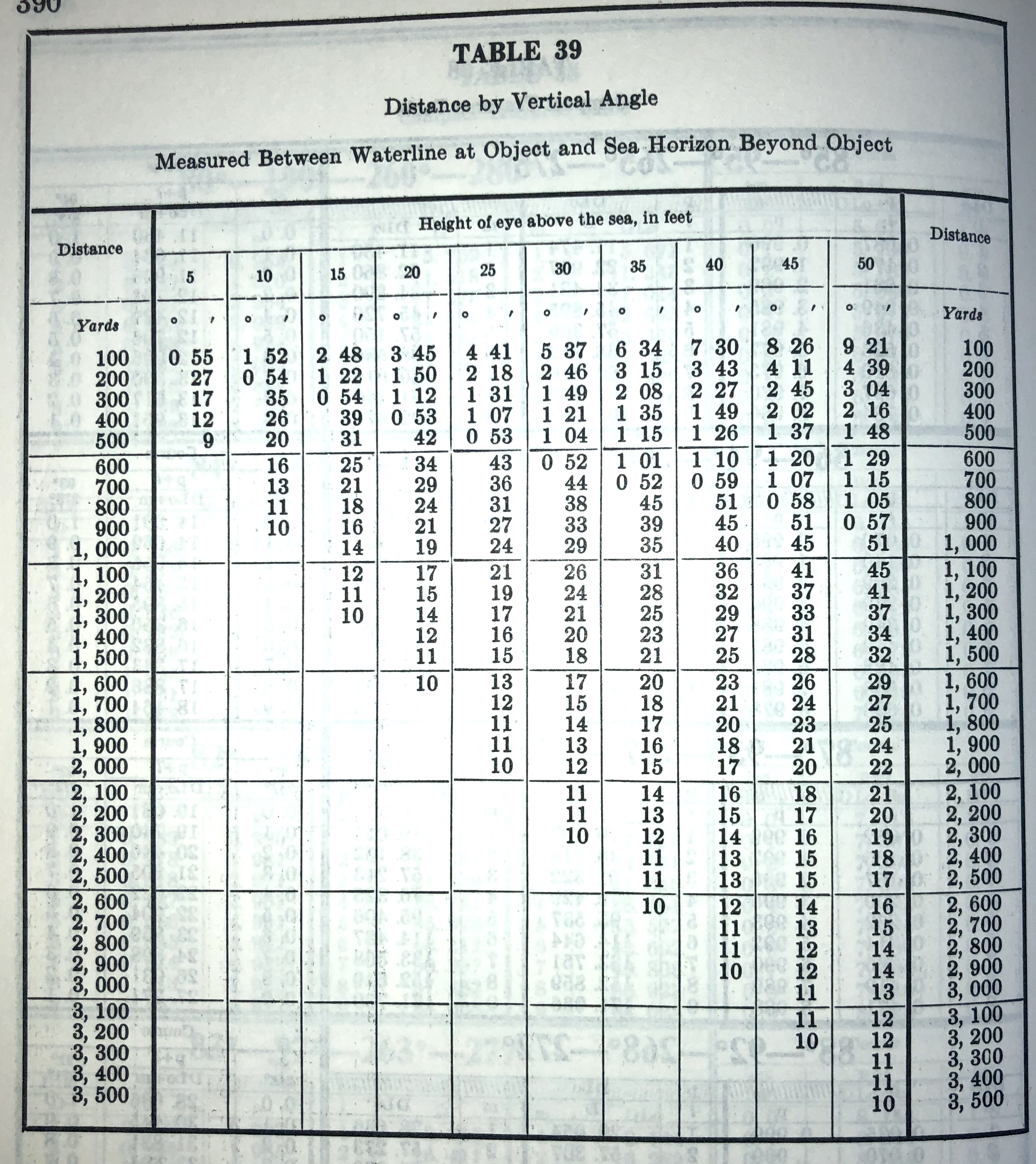
Some time ago I "invented" a way to estimate a distance to a ship by using the HoE correction table alone. It was an error. Robert VanderPol II was kind to provide the dedicated HO-9 Table 39. I'm very uncomfortable with feet|yards|inches, so I decided to reverse-engineer that table.
In metric units the formula behind that method is:
- dist[m] = HoE[m]·ctg(dip+α) = HoE[m] / tg(dip+α)
where α is the angle between the waterline of the object and the horizon behind the object; the dip is the familiar HoE correction angle taken arithmetically (without the sign).
May be it is a bicycle invention but I did not meet this formula in the wild.
Hope it helps (me).
Warm regards,
Tony
60°N 30°E


