
NavList:
A Community Devoted to the Preservation and Practice of Celestial Navigation and Other Methods of Traditional Wayfinding


From: Frank Reed
Date: 2025 Aug 26, 10:56 -0700
The Mercator projection is junk. It should have been consigned to the dustbin of history by the late twentieth century, and, in fact, that's where it was headed. But then came the power of the internet, managed and designed by tech-nerds, who brought the Mercator projection roaring back to its rightful place high on the Throne of Stupid Things. It did serve a very small role in the efficiency of early online mapping products. As computing power has advanced, it has once again become possible to consider ditching this beast.
There is a new push to get rid of the Mercator projection in common mapping apps and other resources. This time around it has the backing of the member states of the "African Union" since the distortions of the Mercator projection work against countries and landmasses near the equator and magnify landmasses in high latitude.
Multiple news sources have picked up on this, and they are mostly treating it as "fluff" without real significance. A few options: Washington Post today, Telegraph two days ago, New York Times five days ago, and NPR also five days ago [NOTE: the WaPo and NYT links should be "free" shares, if I have done this right, and the NPR link should also be open... leaving only the 'Telegraph' coverage behind a paywall... I think].
Many fans of the Mercator projection will happily inform us that "of course the Mercator projection is useful in navigation, at least when practiced in traditional manner". Of course, "everyone knows that". This is a common feature of a defense of any obsolete tool where people who have "heard of" user-groups who "supposedly" depend on the obsolete tool and their rights must be protected! And it's typically described as common knowledge... "we all know that". But if you inquire a little deeper, the folks making such claims usually only have a vague, second-hand knowledge of this antique value to imagined user-groups. It's "common knowledge" because nobody really knows about it.
And then we have fans of traditional navigation, like NavList members as well as others, who will swear on a stack of logarithm tables that the Mercator projection is essential to a marine or air navigator sailing on a rhumbline path. Aha... a little jargon makes it sound real... But the ancient practice of sailing on a rhumbline was rarely "real" in the first place (since magnetic compasses do not even remotely provided true course on the globe), and since this was a type of dead reckoning navigation with only modest connection to the truth path "over ground". More importantly, a rhumbline, a constant beaing course, which is a lovely, perfect, absolutely straight line on a Mercator chart of the world, has no other value besides the ease of drawing it. It optimizes nothing useful. The rhumbline path is pointless except as a foil of comparison with other tracks that do serve some optmization function.
How many generations of navigators were taught to obsessively calculate or look up "meridional parts" (a measure of distance on a Mercator chart)? How many obsess about such matters even today and are taught in preparation for absurdly obsolete US Coast Guard exams that the small corrections for the Earth's oblateness are critical to their navigation?! And all of this hyper-focused on a mapping projection that is obsolete.
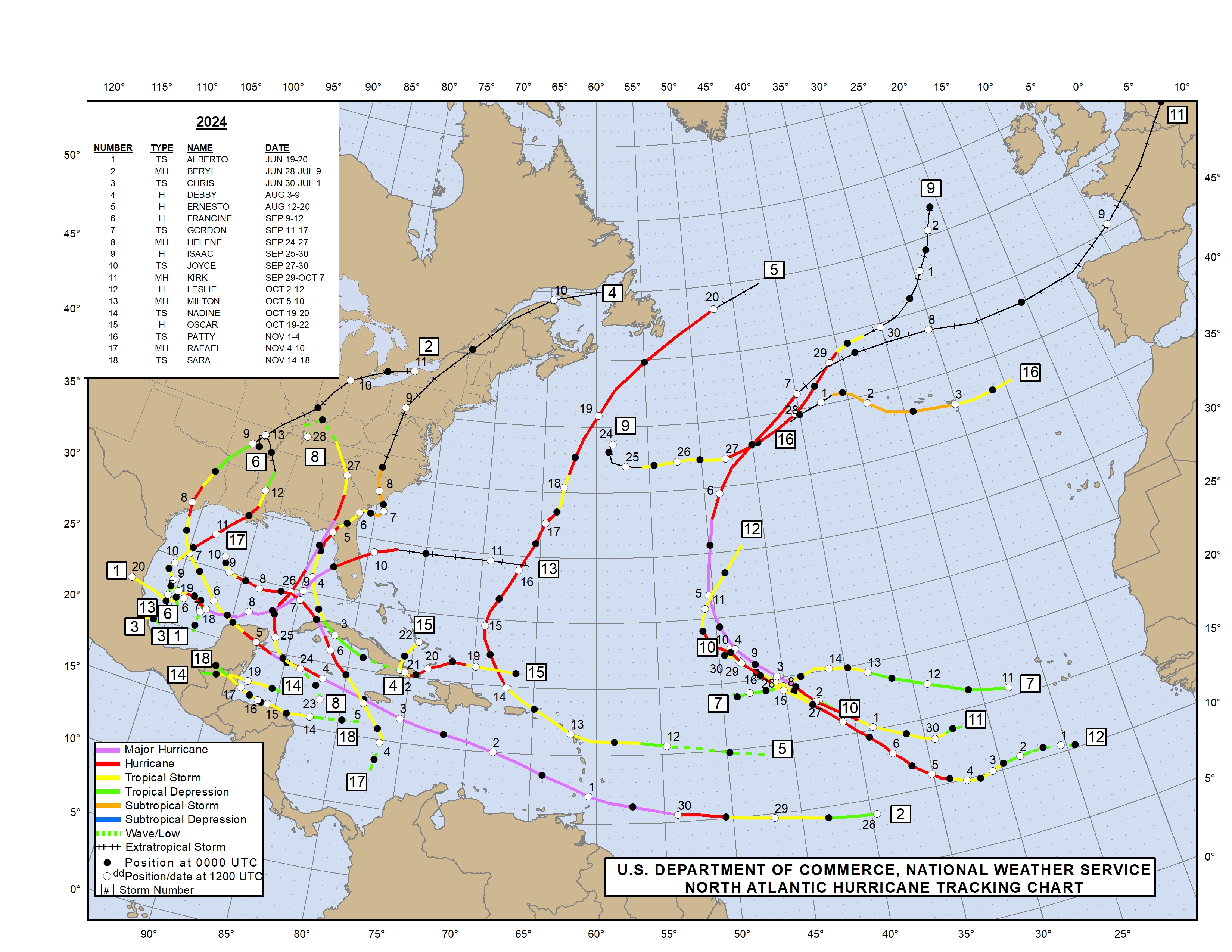
There is, incidentally, one more "user-group" for the Mercator projection: meteorology. For example, hurricane track charts are still regularly drawn on a Mercator projection. This is fine, when the change in latitude is not great, for example in the low tropical North Atlantic latitudes where storms often form, but it becomes a severe distortion for storms that reach higher latitudes, like the Canadian Maritimes, and leads to bizarre illusions of speed in still higher latitudes (for post-tropical remnants usually) as those systems rocket towards giant Iceland (giant on the Mercator projection). Yet even in this user group, when they have the time and the luxury of creating better representations, the Mercator projection is ditched.
For education and the political understanding that follows from it, the Mercator projection has been a pox. Generations of westerners have misunderstood the relative sizes of regions on the globe. Scandinavia looks as big as the southern third of Africa on a Mercator projection. Even today, the uninformed are shocked and determined to doubt social media memes that demonstrate graphically that the USA, China, India, and a dozen other "major" countries can fit inside the outline of Africa with lots of room to spare. Size isn't everything, by any means, but it's a good place to start.
It's time. The Mercator projection is junk.
Frank Reed
Clockwork Mapping / ReedNavigation.com
Conanicut Island USA


