NavList:
A Community Devoted to the Preservation and Practice of Celestial Navigation and Other Methods of Traditional Wayfinding
From: Brad Morris
Date: 2018 Dec 10, 22:43 -0500
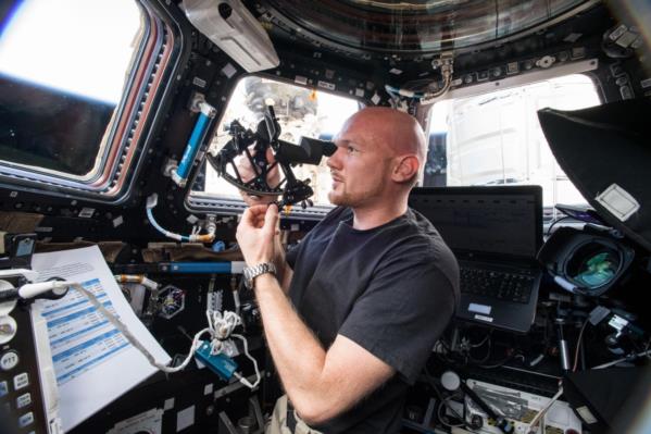
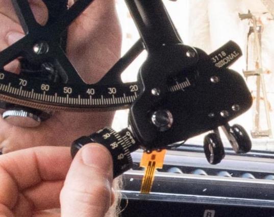
I was reminded after observing the ISS tonight that there are some interesting details in a photo that NASA published a few months ago. It shows ESA astronaut Alexander Gerst trying out the Celestaire Astra II (Is it really a "II"?) sextant. If we zoom in on the micrometer, it's currently reading 34.0'. But checking the main scale, that's below 0° so it's actually reading 26.0' off the arc. Did someone forget to zero out the index error? Was Gerst not trained in this task?? Or maybe he's just posing for the camera?
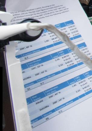
In the procedures, we see some pointlessly detailed and choreographed instructions for observing pairs of stars. These stars are quite close together, and therefore the angles are relatively easy to measure with a sextant. There are some odd details in the list. There's only a "th" visible for one star, but that's clearly Alioth in Ursa Major (in the handle of the Big Dipper). We also see Alkaid (at the end of the handle). But the oddity is "zetUMa". It's no crime to call it zetUMa, short for zeta Ursa Majoris, but that's Mizar! Of the three stars here, that name is more widely known than Alioth or Alkaid. Why do that? Why would anyone choose "zetUMa" over "Mizar"?? Well, no matter -- it's just a star name.
Next, have a look at the rough coordinates for the stars. I checked a couple of the declinations, and they're truncated rather than rounded. That's odd. It doesn't do any harm in this context, but there's no valid reason to truncate. You can also easily double-check the star-to-star angular distances. They're showing 6°40.5' for the Alkaid-Mizar distance (with tenths of a minute oddly placed in a separate box). But why give the angle at all? If the point of this experiment is to test whether angles can be measured reliably by an astronaut in the ISS Cupola (a uniquely forgiving vantage point!), then why provide the answers!? This guarantees biased results.
I maintain that this is NASA "busy work". It looks good on camera, and it's easy to explain to the folks in Congress. The navigation value of this is near zero.
Frank Reed
Clockwork Mapping / ReedNavigation.com / HistoricalAtlas.com
Conanicut Island USA


