Welcome to the NavList Message Boards.

NavList:

A Community Devoted to the Preservation and Practice of Celestial Navigation and Other Methods of Traditional Wayfinding

Compose Your Message

Message:αβγ
Message:abc
Add Images & Files
    Name or NavList Code:
    Email:
       
    Reply
    Weems Star Altitude Curves
    From: Dave Walden
    Date: 2009 Apr 3, 02:28 -0700

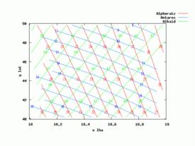
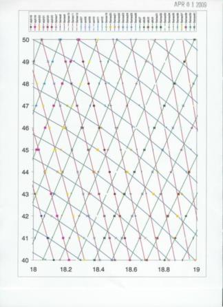
    Star Altitude Curves were meant to be used in high speed aircraft.  Older exts 
    on aircraft navigation give descriptions.  (Particularly those by Weems.)
    
    Attached are works in progress.  An excel spread sheet to compute and plot a 
    set of curves.  (Excel's forte is not plotting!)  And a gnuplot input file. 
    (gnuplot is an open source plotting program for linux and windows.)  Turns 
    out to be far from straight forward to label the curves neatly.  Suggestions?
    
    File:


    File:


    File: 107855.lhacalcfromalt.xls
    File:


    File:


    Reply
    Browse Files

    Drop Files

    NavList

    What is NavList?

    Get a NavList ID Code

    Name:
    (please, no nicknames or handles)
    Email:
    Do you want to receive all group messages by email?
    Yes No

    A NavList ID Code guarantees your identity in NavList posts and allows faster posting of messages.

    Retrieve a NavList ID Code

    Enter the email address associated with your NavList messages. Your NavList code will be emailed to you immediately.
    Email:

    Email Settings

    NavList ID Code:

    Custom Index

    Subject:
    Author:
    Start date: (yyyymm dd)
    End date: (yyyymm dd)

    Visit this site
    Visit this site
    Visit this site
    Visit this site
    Visit this site
    Visit this site