NavList:
A Community Devoted to the Preservation and Practice of Celestial Navigation and Other Methods of Traditional Wayfinding
Re: Assumed altitude method
From: Dave Walden
Date: 2009 Jul 10, 14:50 -0700
From: Dave Walden
Date: 2009 Jul 10, 14:50 -0700
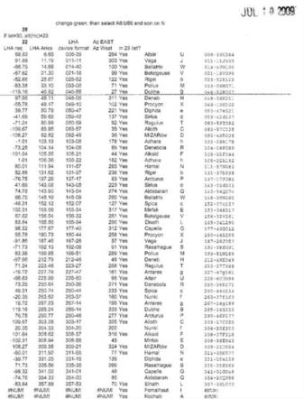
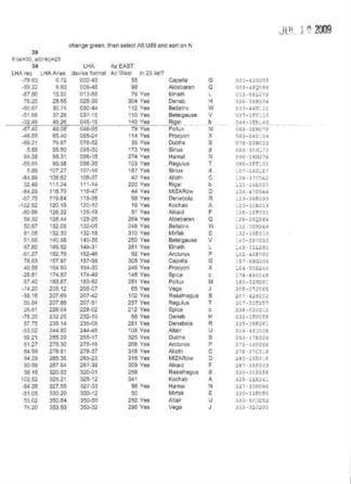
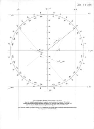
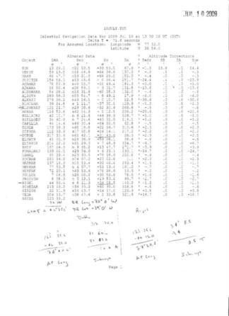
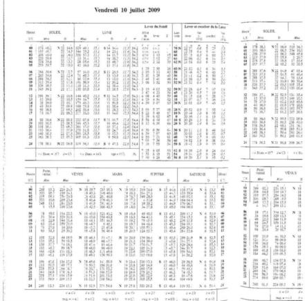
>Dave, >Can you describe it briefly? Thanks. > >-FER Well, perhaps not briefly. :) I have read "The Method of Assumed Altitudes: A New Approach to an Old Art" by T.D. Davies (from the ION disk). I don't yet have any of Davies' Tables themselves. Based on the article, I have worked up the attached spread sheet which reproduces his Figure 3, a sample page from the Tables. (I did use current RA's and Dec's vice his 1980, but more about this later. And thanks to Andres Ruiz for his program which produces nicely formated lists of names, RA's, and Dec's. ) This leads me to have some confidence that I am understanding his method so far. The method requires this special table. The procedure is to observe a bright star. (Here comes the perhaps too bold assumption that it is one of the 42 stars included in the Table.) The Table is then entered with assumed latitude, the nearest whole degree to the DR latitude, and the observed altitude, to the nearest whole degree. On the latitude page, one scans down the altitude column for the LHA of Aries value closest to the current value. (If the assumption above is true, a close value will be found.) One takes out from the Table, the LHA of Aries and the true azimuth. One now calculates an assumed Longitude based on the known GHA of Aries to yield this LHA of Aries. From this assumed position, plot the azimuth given in the Table and the intercept based on the difference between the obseved altitude and the nearest whole degree altitude (the column heading). An example is given: At sea (well, on station), at 13h 00m 00s, 7 July 2009, observed altitude of a bright star bearing NNE is corrected to be 21 degrees 43.6 minutes. (The USNO Ice program is used to simulate the sextant observation. Scan attached.) Approximate position, 39 degrees 00 minutes North, 77 degrees 00 minutes West. Required: LOP by Method of Assumed Altitudes, optionally, the name of the star. Nautical Almanac (well, Ephemerides nautiques, scan attached) gives GHA Aries 123 degrees, 35.2 minutes. Minus assumed Longitude West, gives LHA Aries 46 degrees 35.2 minutes. Now open Table to Latitude 39 degrees North, and turn to column for 22 degrees altitude. (Scan attached.) Moving down, one comes to the (cryptic?) entry, "46-55B 27". This is taken to mean that if the Latitude were 39 degrees North, and if the altitude of star "B" were exactly 22 degrees, the LHA of Aries would, of necessity, be 46 degrees, 55 minutes. One then subtracts this LHA of Aries from the Almanc vaule of GHA Aries to get the assumed Longitude of 76 degrees 40.2 minutes West. From this AP, one lays down the azimuth in the tablulated 27 degree direction. The intercept is the difference between the observed and the 22 degree nearest value or 16.4 nm. (Scan of plot attached.) In the explanatory material with the Table (or spread sheet), one learns that "B" is Dubhe. A second example: Immediately (!) following, at sea (well, on station), at 13h 00m 00s, 7 July 2009, observed altitude of a bright star bearing SE is corrected to be 34 degrees 8.5 minutes. (The USNO Ice program is used to simulate sextant observation. Scan attached.) Approximate position, 39 degrees 00 minutes North, 77 degrees 00 minutes West. Required: LOP by Method of Assumed Altitudes, optionally, the name of the star. LEFT TO THE READER. Corrections/comments welcome. --~--~---------~--~----~------------~-------~--~----~ NavList message boards: www.fer3.com/arc Or post by email to: NavList@fer3.com To , email NavList-@fer3.com -~----------~----~----~----~------~----~------~--~---
File: 109070.t10julydw2.xls
