NavList:
A Community Devoted to the Preservation and Practice of Celestial Navigation and Other Methods of Traditional Wayfinding
Re: Sun Moon Lunars to 155 degrees
From: George Huxtable
Date: 2010 Apr 3, 19:20 +0100
From: George Huxtable
Date: 2010 Apr 3, 19:20 +0100
Following Kermit's request, here's a collection of information about that
harbour on Ulietea, which all dates from Cook's earlier visit in Endeavour
in 1769, not the stay of Resolution and Adventure in 1773. However, I
expect that the 1773 anchorage will probably have been in a similar spot.

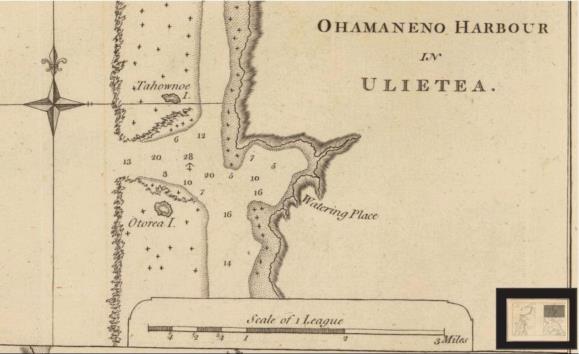
He can put that together with the chart in the linked file at-
http://www.fer3.com/arc/imgx/raiatea-73.jpg

which, it should be noted, is upside down, South at the top.

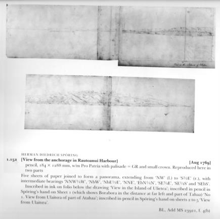
The profile of the island, drawn by Sporing, and shown in raiatea 4.jpg, is
the best copy I can make. It's very indistinct, but hardly any worse than
the picture that it was scanned from. The caption mentions various bearing
directions marked, which would have been most useful, but I can make out
none of those markings.

With a height of eye of 23 feet, a true horizon is just over 5 miles away.
As the coastline to the North is about 7 or 8 miles distant, the horizon
below it should be a true one.

As for the arrival date, Cook's Journal (which I think was keeping civil
time) states on 7 Sept 1773-

We got off the harbour of Ohamamaneno at dark the close of the day where we
spent the night making short boards. The night was dark but we were guided
by the many fishing lights that were on the reefs and shores of the
islands"

Then on the Wednesday 8th they found temporary anchorage outside the
entrance and used the ship's boats to carry in anchors and hawsers, and
warped in, which took most of the day for the two vessels. The problem was
a steady current which flowed contiuously out through the gap in the reef.

==================

Thanks to Kermit for explaining abvout his usage of delta-T. Now I
understand, though I was a bit slow to.

Kermit's method, developed back in his student days, was indeed highly
inventive. Instead of flying jets around today, perhaps he should really be
back in the 18th century, navigating for Bougainville or La Perouse. With
Kermit on board, I'm sure La Perouse would have got back to France.

George.

contact George Huxtable, at  george@hux.me.uk
or at +44 1865 820222 (from UK, 01865 820222)
or at 1 Sandy Lane, Southmoor, Abingdon, Oxon OX13 5HX, UK.
----- Original Message -----


