NavList:
A Community Devoted to the Preservation and Practice of Celestial Navigation and Other Methods of Traditional Wayfinding
Re: USS Fitzgerald collision with container ship
From: Frank Reed
Date: 2017 Jun 26, 13:49 -0700
From: Frank Reed
Date: 2017 Jun 26, 13:49 -0700
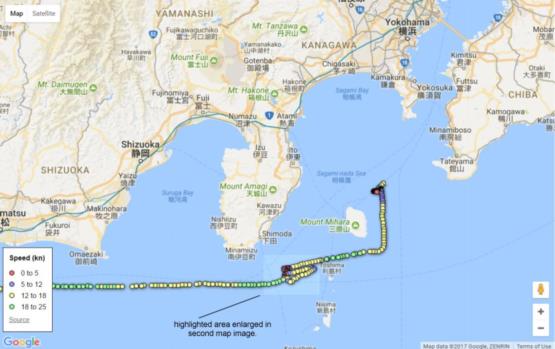
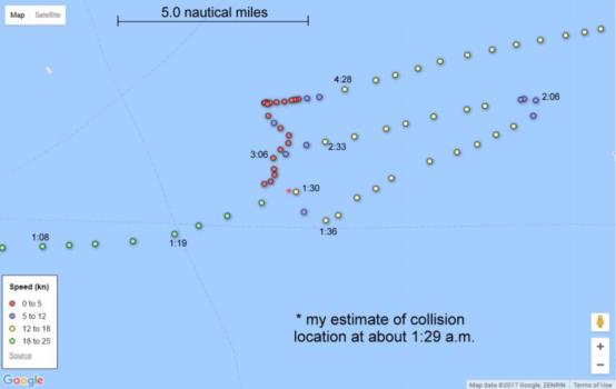
Some of you may not have seen the AIS track data for the container ship ACX Crystal. The two maps attached here may help. Note again that we have no similar data for USS Fitzgerald. The first map shows the general context of the track leading from Nagoya (a port just off the map to the west) towards Yokohama. The second map enlarges the highlighted area and includes the time stamps on some of the AIS data points. Note that the time intervals between the points vary, but are typically from 2 to 4 minutes, so speed should be judged primarily by the color codes. I created these images from the orginal data plotted at the vesselofinterest blog here.
Frank Reed


