NavList:
A Community Devoted to the Preservation and Practice of Celestial Navigation and Other Methods of Traditional Wayfinding
From: Frank Reed
Date: 2014 Dec 11, 12:52 -0800
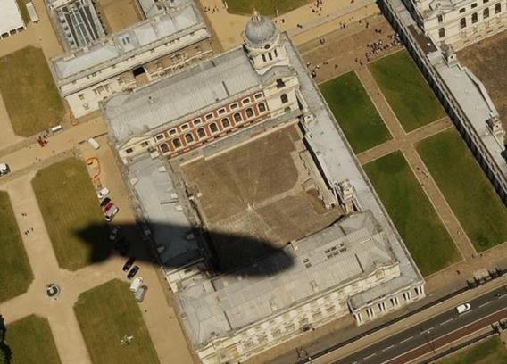
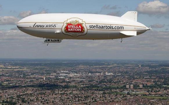
This is a fun idea. Using a sextant for the angles is probably overkill, but we all have flown and seen the shadow of our aircraft, on the ground or on a cloud deck below (maybe wrapped in a 'glory'). How well can you determine your altitude by observing an aircraft's shadow? Sticking with the original topic David Pike mentioned of an airship in 1919, I hit Google Images and searched on 'airship shadow'. There are plenty of hits. I like the image here showing the shadow of an airship advertising "Stella Artois" over London six years ago. How high is this zeppelin? Note that this is a "Zeppelin NT" airship which according to Wikipedia is 75 meters in length. If you're interested in Sun angles, I would estimate that the photos were taken around July 10 (in 2008, but that won't make any real difference).
Frank Reed
ReedNavigation.com / HistoricalAtlas.com
Conanicut Island USA


