NavList:
A Community Devoted to the Preservation and Practice of Celestial Navigation and Other Methods of Traditional Wayfinding
From: Gary LaPook
Date: 2016 Jul 26, 17:04 -0700
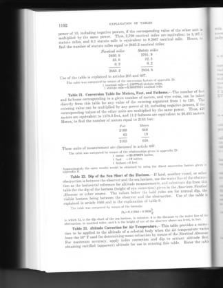
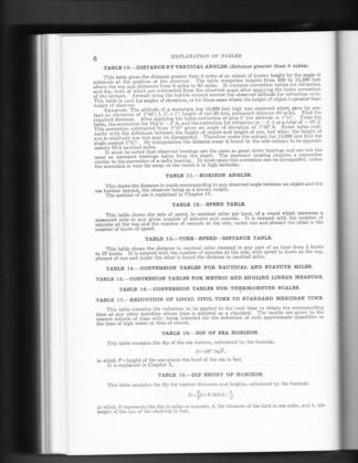
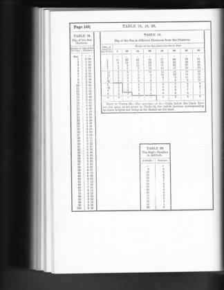
The 1962 and 1977 editions had a different formula, see attached. The 1938 edition a different formula too, see attached. For actual navigation, the only use for these formulas and tables, (table 19 in 1938 and table 22 in 1962 and 1977) is for taking observations while in a convoy in which a nearby ship blocks the horizon directly below the body. 1938 table 19 is more realistic in that it only provides values in whole minutes and only out to 6 NM. Table goes all the way out to 10 NM and provides the corrections to an impossibly pricise 0.1'. Notice that the correction changes approximately 0.1' for a change of the ESTIMATED distance to the waterline of 0.1 NM. If you already know your position to within 0.1 NM then there is no reason to be doing celnav since it will never achieive that level of accuracy.
Table 22 shows that the rule to change the computation when the derived correction is 200' can only happen if the shoreline is within 0.2 NM and only from a height of 75 feet or more, an unlikely combination.
it still amazes me that we discuss how to achieve sub-millimeter accuracy with celnav, it is like stating the amount of water in your swimming pool in teaspoons.
Now it might be fun for us denizens of Navlist to get into all the theoretical details but I wonder if a newby, just tuning into navlist, might just throw up his hands and say he will never be able to learn all of this stuff, and go out and buy another GPS.
gl


