NavList:
A Community Devoted to the Preservation and Practice of Celestial Navigation and Other Methods of Traditional Wayfinding
From: Chuck Varney
Date: 2024 Jun 2, 13:10 -0700
Jeff Hitchcox,
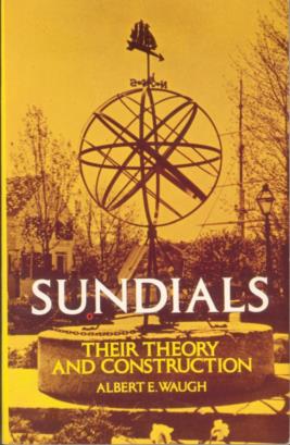
The ‘Sundials’ cover image you posted is horribly distorted (vertically compressed), resulting in the apparent reduction in gnomon altitude angle. I have attached a scan of the cover of my copy of ‘Sundials’, which I’ve had for decades. For all intents and purposes, it’s identical to the black and white image that Frank posted.
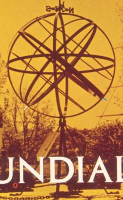
While a proper (angle and distance) photograph of the sphere should suffice, I thought of another method of measuring the gnomon altitude, requiring only a tape measure. I’ve attached a second scan, cropped from the first – and marked. On it, the angular distance between the yellow mark (support post center) and the blue mark (equator ring) is the gnomon altitude. The angular distance between the yellow mark and the white mark (center of the gnomon lower end) is the gnomon co-altitude.
Method: measure the inside diameter of the meridian ring, and calculate the circumerence. Divide 360 degrees by the circumference to get degrees per unit of measure. Muliply that times the distance measured by tape along the inner surface of the meridian ring between the yellow and blue points to get the gnomon altitude angle. Use the same method for the distance between the yellow and white points for the gnomon co-altitude. The co-altitude method, using the centers of two well defined penetrations of the meridian ring, is likely the better of the two methods.
Using the above information you can just look at the marked armillary sphere photo and see that the yellow-blue distance is greater than the yellow-white distance, which is wrong for a gnomon altitude that should be well under 45 degrees. How that may change with another photo remains to be seen.
Chuck V.


