NavList:
A Community Devoted to the Preservation and Practice of Celestial Navigation and Other Methods of Traditional Wayfinding
From: Robin Stuart
Date: 2017 Oct 19, 14:29 -0700
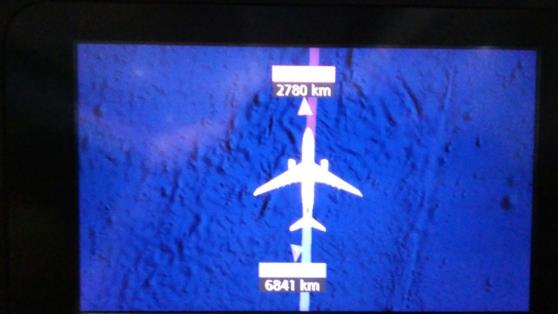
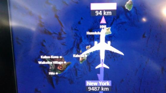
On 2 October I flew from New York’s JFK airport to Honolulu, Hawaii on Hawaiian Airlines flight 51. As the inflight entertainment wasn’t free I spent a good deal of time reading and staring at the real time route map. A number of things seemed odd about it. First the “Time Since Departure” was grossly overstated and, had it been correct, we were probably due to drop out of the sky at any moment. Secondly arrows indicating the directions for New York and Honolulu made what seemed like rather large angles with the current track of the aircraft (see first attachment). I wondered why this might be and speculated that we could be flying close to a great circle but that the arrows showed the rhumbline directions. If that were the case then the distances shown might be rhumbline distances as well and I could determine this by noting the distance to New York as close as possible to Honolulu. The second attachment shows the route map just before it was turned off with a distance of 94km to Honolulu and 9,487km to New York.
Taking
New York 40°39.1′N 73°49.6′W
Honolulu 21°19.5′N 157°57.9′W
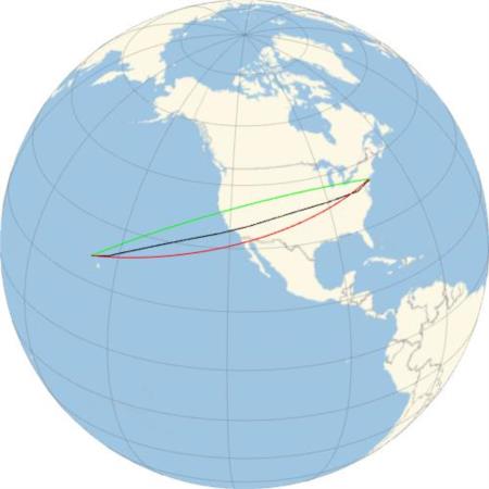
I calculate that the great circle distance is 4,320NM or 8,000km and the rhumbline distance is 4,466NM or 8,272km. I also downloaded the aircraft’s actual flight track from Flightaware.com and find the total distance flown to be 4,446NM or 8,234km.
The inflight display in the first attachment shows 2,780km to Honolulu and 6,841km to New York. At that time the interpolated Flightaware data gives a latitude, longitude of 30.3629°, -134.5397°. This position is 5,500km and 2,540km by great circle from New York and Honolulu respectively and 5,620km and 2,560km on a rhumbline.
Does anyone, particularly pilots on Navlist, understand what might be going on here? Maybe they just wanted to be generous with their frequent flyer miles. I certainly hope that they have better information in the cockpit!
For interest I also plotted (third attachment) the great circle (green), rhumbline (red) and actual tracks (black).
A PUZZLE
Assume that the distances to New York and Honolulu in the first attachment (New York 6,841km, Honolulu 2,780km) are accurate and represent great circle distances. What is the location of the aircraft? This is just the classic double altitude problem.
Assume that the distances to New York and Honolulu in the first attachment (New York 6841km, Honolulu 2780km) are accurate and represent rhumbline distances. What is the location of the aircraft?
Robin Stuart


