NavList:
A Community Devoted to the Preservation and Practice of Celestial Navigation and Other Methods of Traditional Wayfinding
From: Peter Blaskett
Date: 2023 Nov 10, 17:43 -0800
For Antoine.
Well done on your estimate.
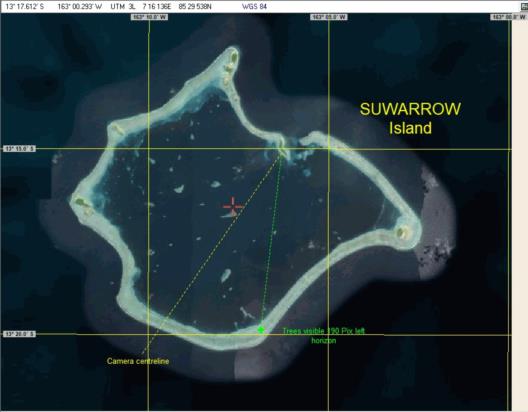
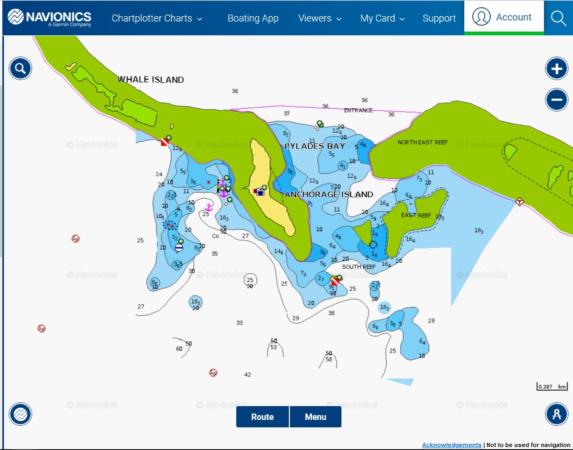
Better position for the site shown on the map. Anchorage plan taken from Navionics.com
As to methods, I use an image package to read out Pixel coordinates. PAINT will do fine.
The assumption that the image is conformal is bad. The image is a perspective projection
of the sphere to a flat plane - think of the picture as a GNOMONIC projection chart, tangent to the sphere at the
picture centre. Big trouble if the picture has been cropped.
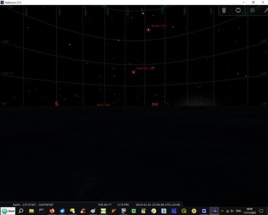
Even if the picture was taken with the camera axis level with the horizon, the measure of angles L/R, and Up/Down
are not uniform. See the Stellarium perspective grid image 1.
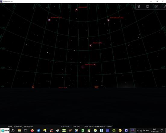
Best to assume the picture in this case was taken pointed up. What angle needs to be found.
Stellarium image 2 shows distortions with an elevated picture axis about 17 degrees. (Peacock is roughly centre)
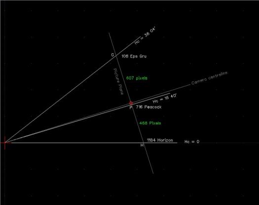
I get elevation of the picture axis about 17.5 degrees. Method by geometry and altitudes of Peacock and Eps Gru
(almost directly above Peacock) and horizon. Geometry picture shown.
As to rectification of plane pespective images, that takes a fat book in itself. Gnomonic projection not so bad.
My rough answer to the question is UT 5hr 56min
