NavList:
A Community Devoted to the Preservation and Practice of Celestial Navigation and Other Methods of Traditional Wayfinding



From: Frank Reed
Date: 2026 Apr 23, 17:13 -0700
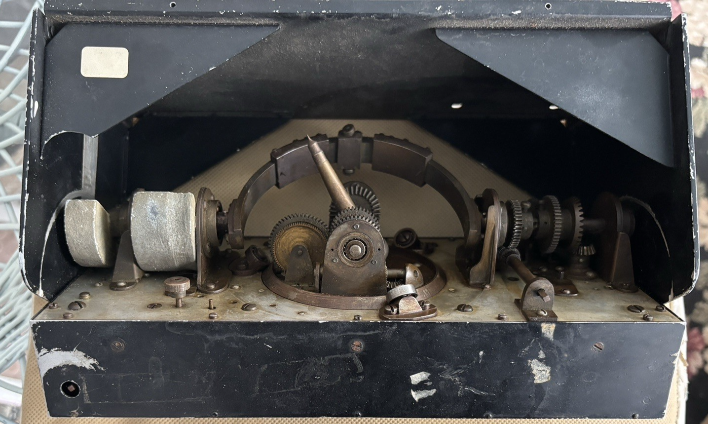
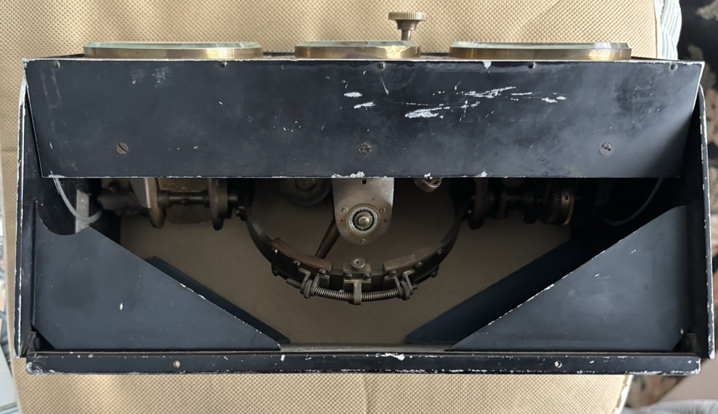
I assume that this device is an analog spherical triangle solver. Tom H, I agree that this was a prototype, probably lovingly constructed by the inventor, but irrelevant in the market of celestial navigation because it was a solved problem. Many such analog computers were created over the two-century period during which "scientific" navigation existed and before electronic tools took over. While adding up logarithms (or equivalent operations in other paper methods) was sometimes tedious work, it just wasn't all that difficult, and equally important it was easy to double-check the work. Analog computers found no useful niche.
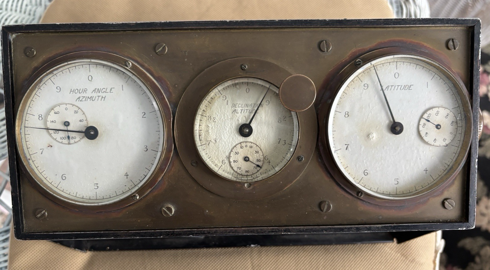
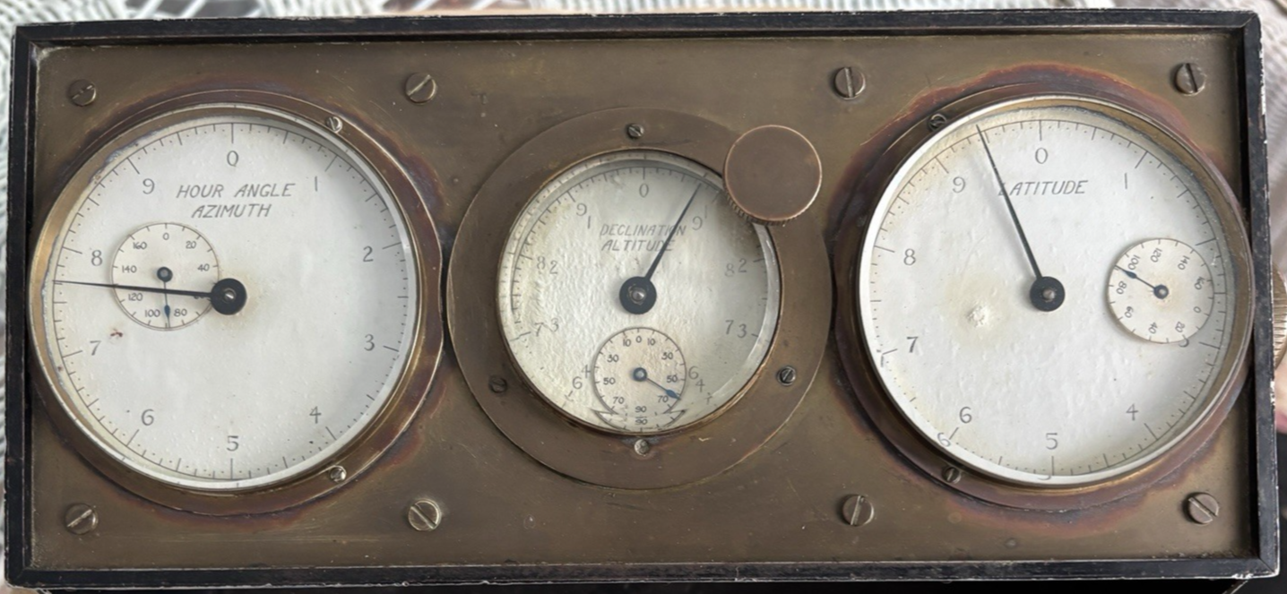
I spent some time pondering the "user interface". We have "hour angle" and "azimuth" on the left dial. The small dial within the left dial reads from 0° to 180° with individual degrees on the primary dial. That scale is easily read to 5' (the dots between the lines on the primary dial are at 5' intervals), and probably readable to 2' by interpolation interpolation. So that makes sense.
On the middle dial we have labels "declination" and "altitude". The small dial within the middle dial shows 0 at the top, through 10, 30, 50, 70 to 90 at the bottom on the left side counter-clockwise and also the same pattern clockwise on the right. This is just what I would expect for a declination dial for the major value. It's covering -90° through 0° to +90°. Then the larger hand reads degrees and every 5' by actual markings and reasonably to about 2' (two minutes of arc) by visual interpolation. That's great for declination, but a little odd for altitude. This could just be a compromise on the dial, or it could be accidental mis-labeling. "Altitude" for "Latitude" would be an easy mistake to make for the artist who created the scales.
On the right-hand dial we have "latitude". The small dial reads from 0° to 180° which doesn't really fit for latitude (or for altitude, for that matter). I notice also that the small dial is on a funny angle, and I think it's likely that the scale (looks like paper?) has gotten stuck to the little "hand".
Back to the middle dial, there is a big knob sticking it out. This could be a setting knob. It could also be some sort of release or clutch that switches the device from entry mode to display mode. In the latter case, it might be that the user would set the hour angle on the left, the declination on the middle dial, then pull the knob to release those. Then by setting the latitude, the other dials would display altitude and azimuth. Maybe something like that. Please note that I am "talking out loud" here, really just speculating...
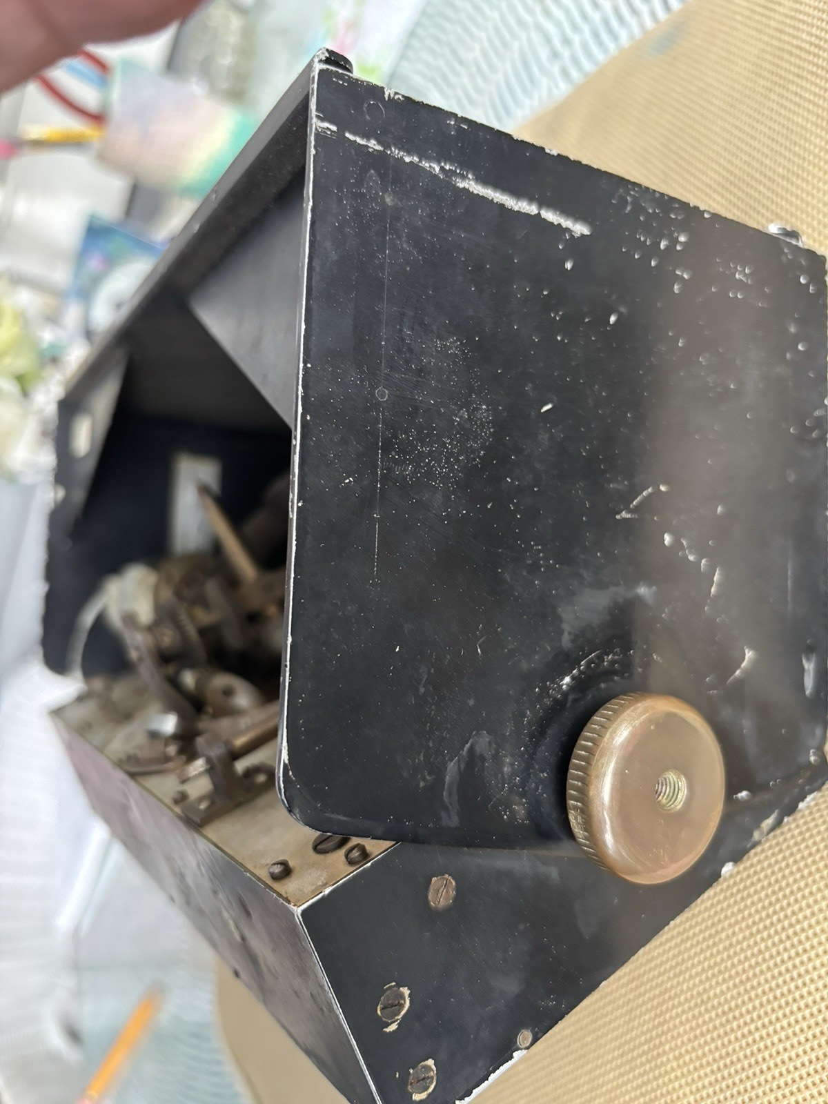
The lack of a maker's label of any sort, the small scales that appear somewhat loose on the device, and the simple construction all suggest a prototype.
Frank Reed