NavList:
A Community Devoted to the Preservation and Practice of Celestial Navigation and Other Methods of Traditional Wayfinding
From: Martin Caminos
Date: 2024 Jan 20, 08:14 -0800
Hello Frank, thank you very much for your valuable comments. I really appreciate it.
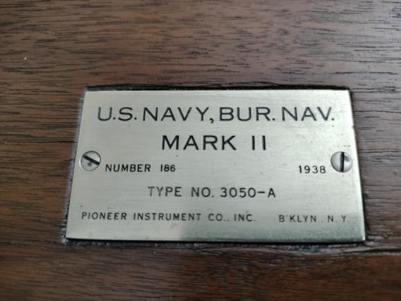
The marine sextant official name is US Navy, Bru. Nav Mark II (please see below a picture of the placard on the case)
My objectives with this trip were to have the experience of the Atlantic crossing on a ship (after many crossings by plane) and practice real time celestial navigation. I am traveling alone, but a couple days ago my wife took a plane from Miami and is already waiting for me in London, where we will spend a few days together and later take plane back to Miami.
I have been to the Greenwich observatory a few times before, so to keep marital harmony I am not going to stop by the “Temple” this time.
The ship heading changes to follow the great circle route have been gradual and I have been taking GPS coordinates every 12 hours, so I do not think that was a major factor of error. By the way, I brought onboard two charts of the north Atlantic, one with Mercator projection and another with Gnomonic projection to plot the ship route deviations from the great circle. This was an interesting exercise!
As you can imagine, because of the relatively chilly weather and wind, there were not many people walking around on the decks, so I have all the space and time needed for the sights. Nobody from the ship’s crew ever asked me what I was doing on the ship’s stern before sunrise looking at the sky with some kind of device (I am sure that they did not know sextant is or how it looks)
Regarding Lunars, I took the sights two days ago because I had to wait until the Moon was visible at night but also had clear skies to take the sights.
I am far from being an expert in Lunars, so all suggestions and comments are welcome on the following procedure:
- I picked Aldebaran to measure the lunar distance because its declination was close to the one of the Moon (around 2 degrees of north declination difference). It is my understanding that the relative similar path on the sky increases the speed between the two bodies and should contribute to get a better precision.
It is my understanding that the best possible precision with the Lunar distance method is 2 minutes, so I am not sure if this would be a satisfactory result on a moving ship.
Thanks!


