NavList:
A Community Devoted to the Preservation and Practice of Celestial Navigation and Other Methods of Traditional Wayfinding
From: David Pike
Date: 2020 May 15, 02:24 -0700
Hello Grace O’farrell
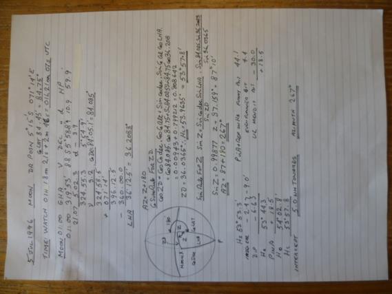
That’s great stuff and good to see. The Moon and the Southern Hemisphere meant I had to put my thinking cap on. Air navigators tend to avoid the moon if they possibly can. I followed most of your working and ended up with the same azimuth and intercept as you, but I used spherical trig directly. I’ve not really studied maritime tables in any depth, but you’ve prompted me to try. I’ve got my dad’s stuff on my bookshelf. I see what you mean now about the minus 30 for the upper limb. It’s a ‘gotcha’.
An air navigator would have approached the problem slightly differently. They would have used an assumed position of 5°S 071°015’E. That would have given round numbers for latitude and LHA. You could go into air navigation tables with those and come out with Hc and Z in seconds. We use bubble sextants and aim at the middle, so we don’t need to worry about dip and semi-diameters. You get the same position line within a mile, but the intercept is different, because you plot it from a different starting position. Here’s hoping you’re not too badly restricted by the Covid crisis and that the Cruise Industry will be up and running again soon (Sorry, I looked you up on LinkedIn!). DaveP


