Welcome to the NavList Message Boards.

NavList:

A Community Devoted to the Preservation and Practice of Celestial Navigation and Other Methods of Traditional Wayfinding

Compose Your Message

Message:αβγ
Message:abc
Add Images & Files
    Name or NavList Code:
    Email:
       
    Reply
    Re: Bombers over Danger Island! A celestial tale
    From: David Pike
    Date: 2026 Sep 7, 14:22 -0700

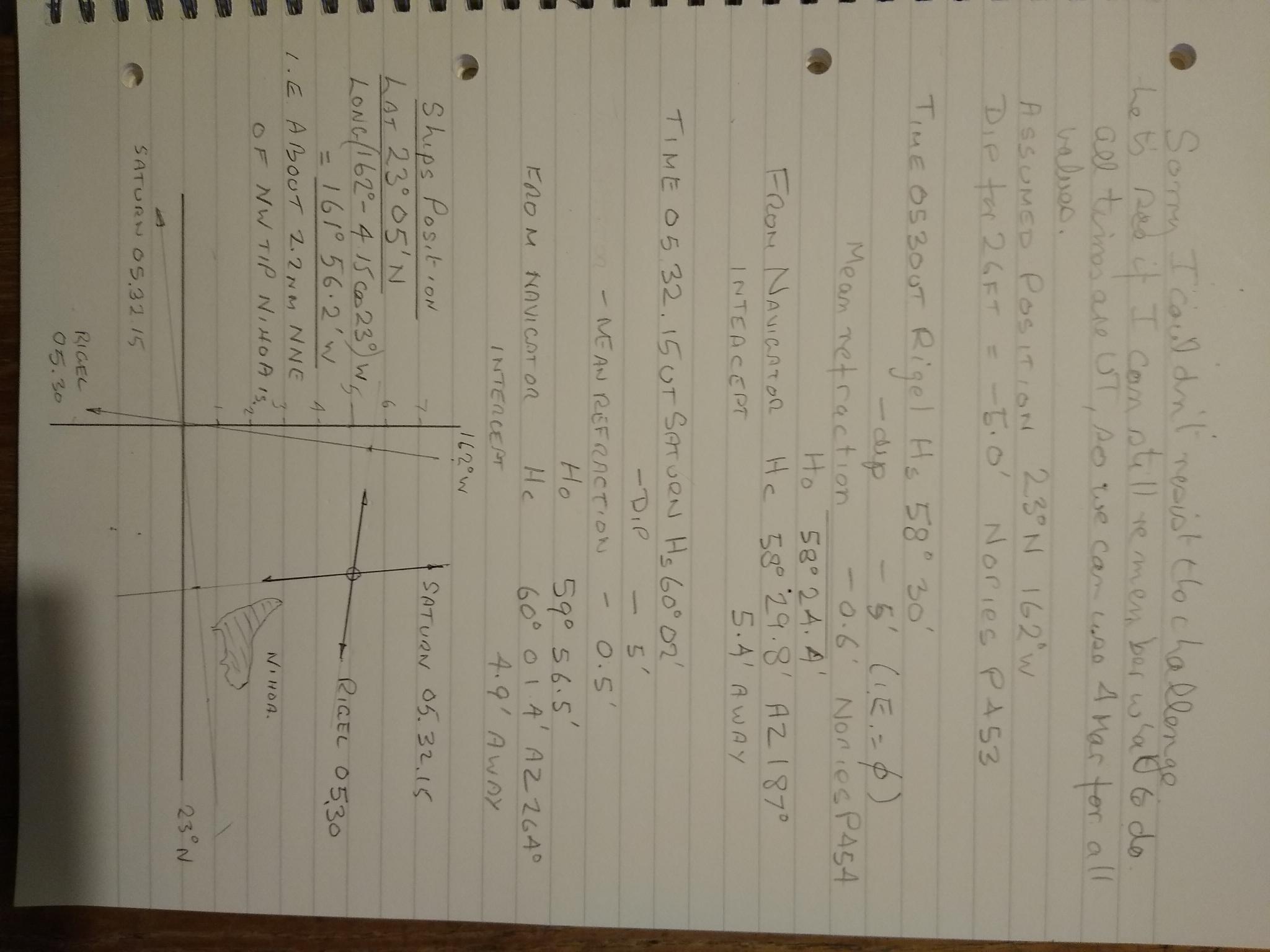
    Sorry, I couldn’t resist the challenge. Let’s see if I can still remember how to do it in this AI / GPNS World. 

    All times are UT from 05.30, so we can safely use information for 4th March 1942.  Please see photograph.  The first fix puts us at 23° 05’N 161° 56.2’W about 2.2nm NNE of the northernmost tip of Nihoa.  You might almost say the ‘Old Man’ was hiding behind the island.  DaveP

    File:

       
    Reply
    Browse Files

    Drop Files

    NavList

    What is NavList?

    Join / Get NavList ID Code

    Name:
    (please, no nicknames or handles)
    Email:
    Do you want to receive all group messages by email?
    Yes No

    A NavList ID Code guarantees your identity in NavList posts and allows faster posting of messages.

    Retrieve a NavList ID Code

    Enter the email address associated with your NavList messages. Your NavList code will be emailed to you immediately.
    Email:

    Email Settings

    NavList ID Code:

    Custom Index

    Subject:
    Author:
    Start date: (yyyymm dd)
    End date: (yyyymm dd)

    Visit this site
    Visit this site
    Visit this site
    Visit this site
    Visit this site
    Visit this site