NavList:
A Community Devoted to the Preservation and Practice of Celestial Navigation and Other Methods of Traditional Wayfinding
From: Robin Stuart
Date: 2024 Mar 12, 10:19 -0700
Frank,
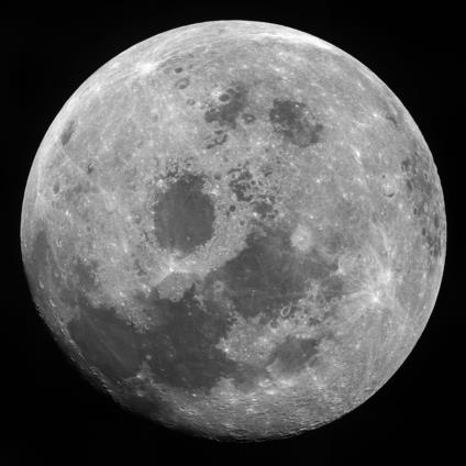
Whenever I see this photograph I feel I want to yell "Hey guys! You're going the wrong way. The Earth is over in that direction."
You asked: Can we describe a general geometric technique for determining distance from the Moon
Probably the quickest and easiest way to get a ballpark figure for the distance at which such a photograph was taken is to simulate it in something like Google Earth which allows you to sit above any location on the Moon's surface and at any altitude. A more precise way of doing it is to measure the pixel locations of small but prominent features and the exact center of the Moon's disk. Then given the selenographic coordinates of the features along with some 3D vector methods it is possible to calculate where they should appear in a photograph taken at a specified altitude. Then you can do a least-squares fit to find the altitude. You should take into account that a photograph is a gnomonic projection. I did this exercise a few years ago and found that the distance did not agree with NASA records which had it being shot with the wrong lens. I wrote this up for our local astronomical club's newsletter. https://westchesterastronomers.org/wp-content/uploads/2021/01/February-2021.pdf. I've excerpted the relevant pages.
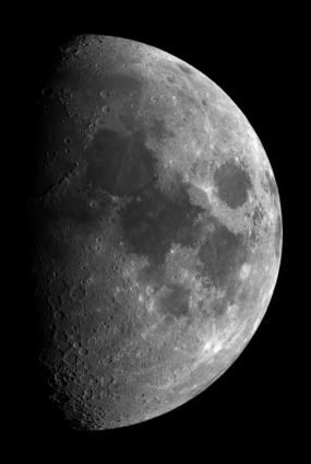
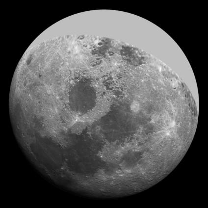
Also I've attached 3 images of the Moon. The first is the Moon as seen by Apollo 11. The second is a picture I took during a favorable libration for viewing features on the eastern limb. The third is that same picture transformed to match the astronauts' view using custom Mathematica code that adjusts the the pixel positions based on my position and that of the astronauts. Obviously they got a better view of the lunar far side. I had to gray mine out but it cost me a lot less to get my view than it did NASA!
Robin Stuart


