NavList:
A Community Devoted to the Preservation and Practice of Celestial Navigation and Other Methods of Traditional Wayfinding
Re: Bris Calibration Image
From: Greg Rudzinski
Date: 2017 Nov 7, 07:46 -0800
From: Greg Rudzinski
Date: 2017 Nov 7, 07:46 -0800
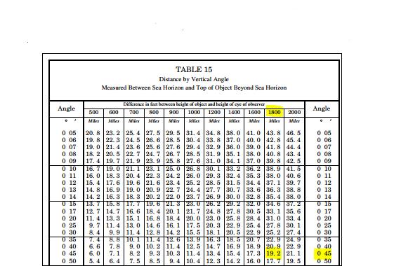
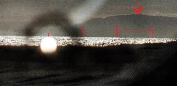
That is correct John. Good job. See attached Bowditch page and chart.
Greg Rudzinski
From: John D. Howard
Date: 2017 Nov 7, 06:45 -0800Greg,
Using table 9 from my 1958 Bowditch , subtracting 2.8' for dip I get 19.17 NM to the mountain.
John H.


