NavList:
A Community Devoted to the Preservation and Practice of Celestial Navigation and Other Methods of Traditional Wayfinding
Bygrave slide rule
From: UNK
Date: 2008 Sep 27, 04:01 -0700
From: UNK
Date: 2008 Sep 27, 04:01 -0700
Gary LaPook writes:


British captain Leonard Bygrave invented his celestial navigation
computer in 1921. It consists of three concentric tubes forming a
cylindrical slide rule designed for the one purpose of calculating
azimuth  (Az)  and altitude (Hc) of celestial bodies. The inner tube is
covered with a spiral log cotangent scale (the patent documents and
other descriptions identify this as a  tangent scale but it is, in fact,
a cotangent scale), the second tube has a spiral log cosine scale and
the third tube carries two pointers used to line up the two trig scales.
In normal slide rules you can align the scales next to each other but
with spiral scales this is not possible so the need for the two
pointers. The advantage is that a spiral scale can be made much longer
than  a normal ten inch slide rule allowing for much greater accuracy
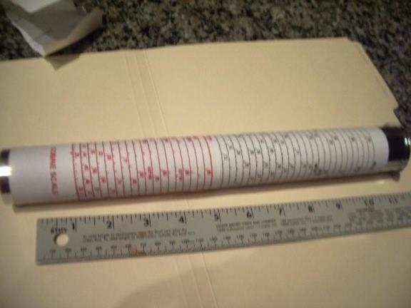
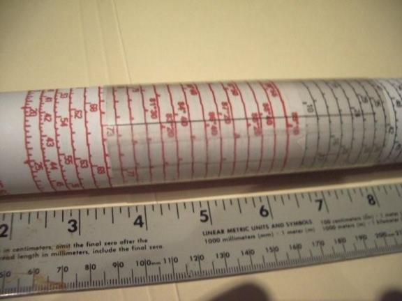
and precision. The cotangent scale on the Bygrave slide rule covers the
range of 0º 20' to 89º 45' by spiraling 44 times around a two and a half
inch diameter tube making this scale  28.8 feet long! The copy I
constructed only covers the range of 0º 55' through 89º 15' by spiraling
37 times around a one and a half inch diameter tube making this scale
14.5 feet long. Each spiral represents a .1 change in the value of the
log cotangent. For example, the log cotangent of 20' is 2.2352 and the
value directly above the 20' mark and up one spiral is 25' 10" which has
a log cotangent of 2.1352, exactly .1 less than the value one spiral
down. Going up 44 turns to the top of the scale and directly above the
20' mark has a log cotangent of -2.1648 exactly 4.4 less than the log
cotangent of 20' and marked as 89º 36.5'.

Bygrave divided the navigational triangle into two right triangles by
dropping a perpendicular from the geographical position to the
observer's meridian. Bygrave labeled the two portions of the observer's
meridian created this way as "y" and "Y" (lower case "y" and upper case
"Y" (go figure?)) which allowed a simplified way to do the necessary
computations which are accomplished as follows.

First, you use the almanac in the usual manner to find GHA and
declination and figure LHA ("H" in Bygrave's system) in the normal
fashion except you do not need to have a whole number of degrees of LHA
so you can work the sight from a DR position.The Bygrave needs the hour
angle (H) to not exceed 180º so, if necessary, subtract the LHA from
360º to bring it within this range. (My reconstruction avoids cluttering
the scales by omitting markings greater than 90º so I must get H within
the range below 90º but the computations work out the same.) Next you
calculate co-latitude by subtracting your latitude (either for your AP
or for your DR) from 90º.

The azimuth and altitude are calculated in three steps using the same
manipulations of the slide rule for each step.


Next calculate "y" which is found by the formula:

    tan y =  tan declination / cos H

This is the formula listed in the patent documents and in the Bygrave
manual but, in fact, the slide rule does the calculation by modifying
this formula to allow the use of the cotangent scale. The actual
manipulation of the slide rule uses the re-arranged formula of:

   cotan y  =  cotan declination x cos H

You accomplish this by setting one of the pointers (or the cursor on my
copy) to zero on the cosine scale and while holding it there rotate the
cosine scale and slide it up or down on the cotangent scale so that the
other pointer (or cursor) is aligned with the declination on the
cotangent scale. Now, holding the cosine scale still, rotate the pointer
(cursor) to point at the hour angle (H) on the cosine scale and then
read out "y" from the other pointer (cursor) where it points on the
cotangent scale.

Next you find "Y" by adding "y" to co-latitude (if latitude and
declination have the same name) or by subtracting "y" from co-latitude
(if of opposite names.)

Next we find azimuth with the formula :

    tan Az  =  (tan H x cos y ) /  cos Y

which is re-arranged into the form:

 cot  Az = (cotan H / cos y  ) x cos Y


Now, using the same manipulations as before, set one pointer to "y" on
the cosine scale and the other pointer on H on the cotangent scale, move
the cursor to "Y" on the cosine scale and read out azimuth from the
other pointer on the cotangent scale.

The third step calculates altitude, Hc. using the formula:


 tan Hc = cos Az x tan Y

 with the formula re-arranged into the form:

    cot  Hc  = cot Y / cos Az

 set one pointer to Az on the cosine scale with the other pointer to "Y"
on the cotangent scale. move the pointer to zero on the cosine scale and
read our Hc from the other pointer on the cotangent scale.


Done, and it only takes two minutes and produces an accuracy of one or
two minutes of arc, uses no electrons or large books. It is easier to do
than it is to describe. You can also use these formulas with a digital
calculator.

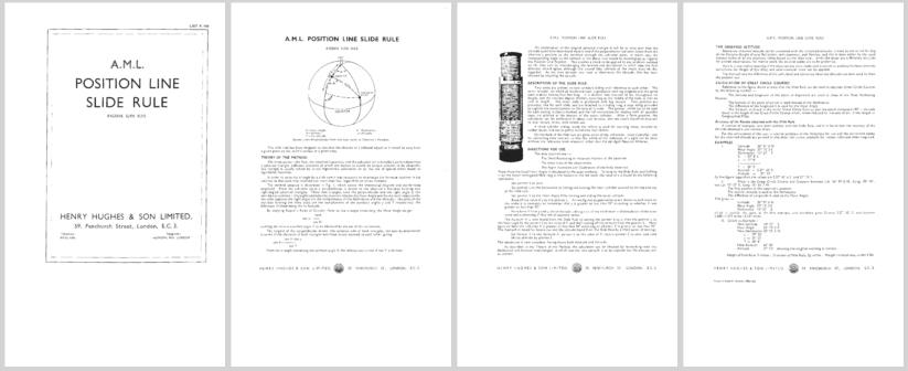
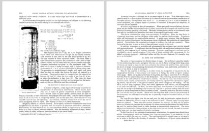
I have attached the Bygrave manual, patent  and pictures of the instrument.
gl


This slide rule uses

--~--~---------~--~----~------------~-------~--~----~
Navigation List archive: www.navlist.net
To post, email NavList@navlist.net
To , email NavList-@navlist.net
-~----------~----~----~----~------~----~------~--~---


