NavList:
A Community Devoted to the Preservation and Practice of Celestial Navigation and Other Methods of Traditional Wayfinding
From: Frank Reed
Date: 2010 Jan 31, 21:47 -0800
Jeremy, you wrote:
"Ironically, I lived in the shadow of Mt Palomar for a few years. I could see it from my front yard. I was on the Riverside County side of things, so it was a better than hour drive to actually get up there to visit. "
I drove in from the east and when I reached the first summit of the plateau there, I knew roughly where Palomar Mountain would be so naturally I was looking. At a distance which I later found to be 19.5 statute miles I could see the big white dome gleaming in the distance. That was still about an hour away. When you get there, there's little to see unless you're a fan of big telescopes and history. No one looks through that giant telescope (except digital sensors) and there's nothing going on up on the mountaintop. But I was genuinely thrilled to see it. The dome was much bigger up close than I expected. And the drive up that mountain really is spectacular. Even the portion that was torched by recent forest fires is quite impressive.
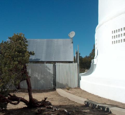
Attached is a photo of something I found around back of the telescope's dome. I imagine the telescope operators have little to do at night while the automated observing programs are running so I suppose they deserve some entertainment. That's a DirecTV dish, not a radio telescope! ;-) And that provides a nice lead-in to a bit of positional astronomy software that I wrote back in the early 1990s. In 1993 I bought the very first DirecTV system ever installed in the city of Chicago. In those early years, there were very few professional installers so you had to wiggle the dish around manually until it was pointed at the right spot in the sky. Positioning the dish on the roof by varying both azimuth and elevation and then running back inside to check signal strength was tedious work and the orientation was different for every latitude and longitude in the US. So I wrote a little bit of DOS software which calculated the exact time of day for a given location and day of the year when the Sun would be in the same azimuth as the DirecTV satellites. Then one could wait until that time of day, align the dish's receiving arm until the shadow was minimized, and quickly run through the elevation angle without worrying about azimuth. It was a very popular download on Compuserve for a while. Alas, poor Compuserve... I knew him well. That was the only practical application I found for my nautical astronomy knowledge back in the early 1990s, by the way.
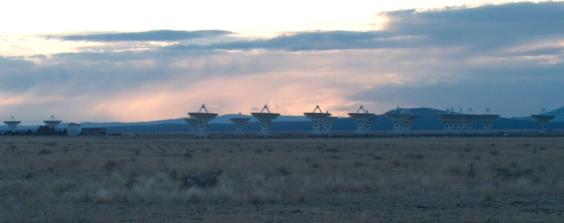
I am also attaching a photo of the VLA at sunset.
-FER
----------------------------------------------------------------
NavList message boards and member settings: www.fer3.com/NavList
Members may optionally receive posts by email.
To cancel email delivery, send a message to NoMail[at]fer3.com
----------------------------------------------------------------


