NavList:
A Community Devoted to the Preservation and Practice of Celestial Navigation and Other Methods of Traditional Wayfinding
Re: Cape Belsham
From: Robin Stuart
Date: 2017 Jan 29, 13:53 -0800
From: Robin Stuart
Date: 2017 Jan 29, 13:53 -0800
Brad,
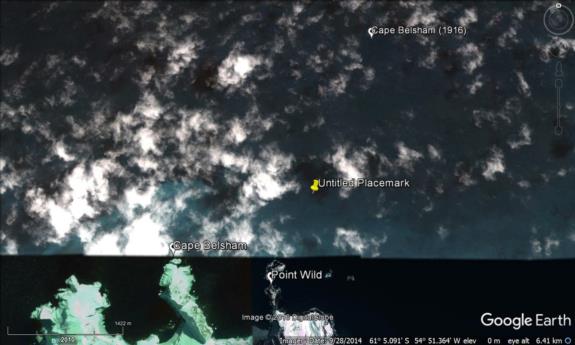
The scale of Chart 29104 might make it a bit of a blunt instrument for these calculations and the Joint Services Expedition Chart might give different results. When plotted on Google Earth I got 61°5.7'S 54°53'W which is further from Worsley's position than yours. The attached snapshot shows Worsley's position labelled "Cape Belsham (1916)" and you are the "Untitled Placemark". It could also be that Google Earth has wrong.
Here I issue the usual disclaimer that the difference is inconsequential in the overall conclusion....etc, etc.
Regards,
Robin


