NavList:
A Community Devoted to the Preservation and Practice of Celestial Navigation and Other Methods of Traditional Wayfinding



From: Patrick Twohy
Date: 2026 Aug 3, 13:57 -0700
Lots of opportunities to mess this up, each one an opportunity to learn something, I guess. Here goes...
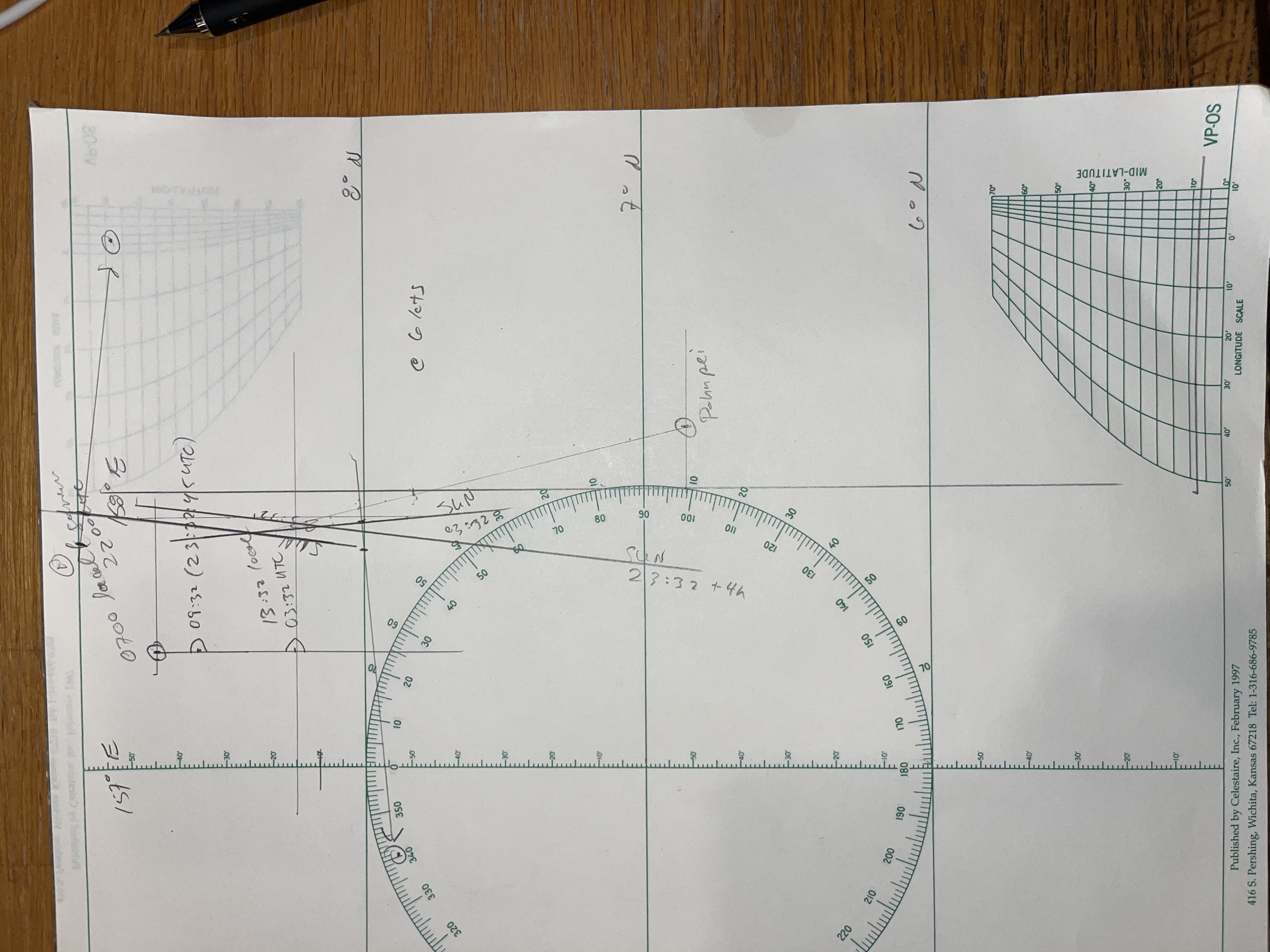
You're headed for Pohnpei Island, (and thanks, DaveP for the link to Sweet Caroline!).
It happens to be very roughly south of your DR position of 1 hour after sunrise.
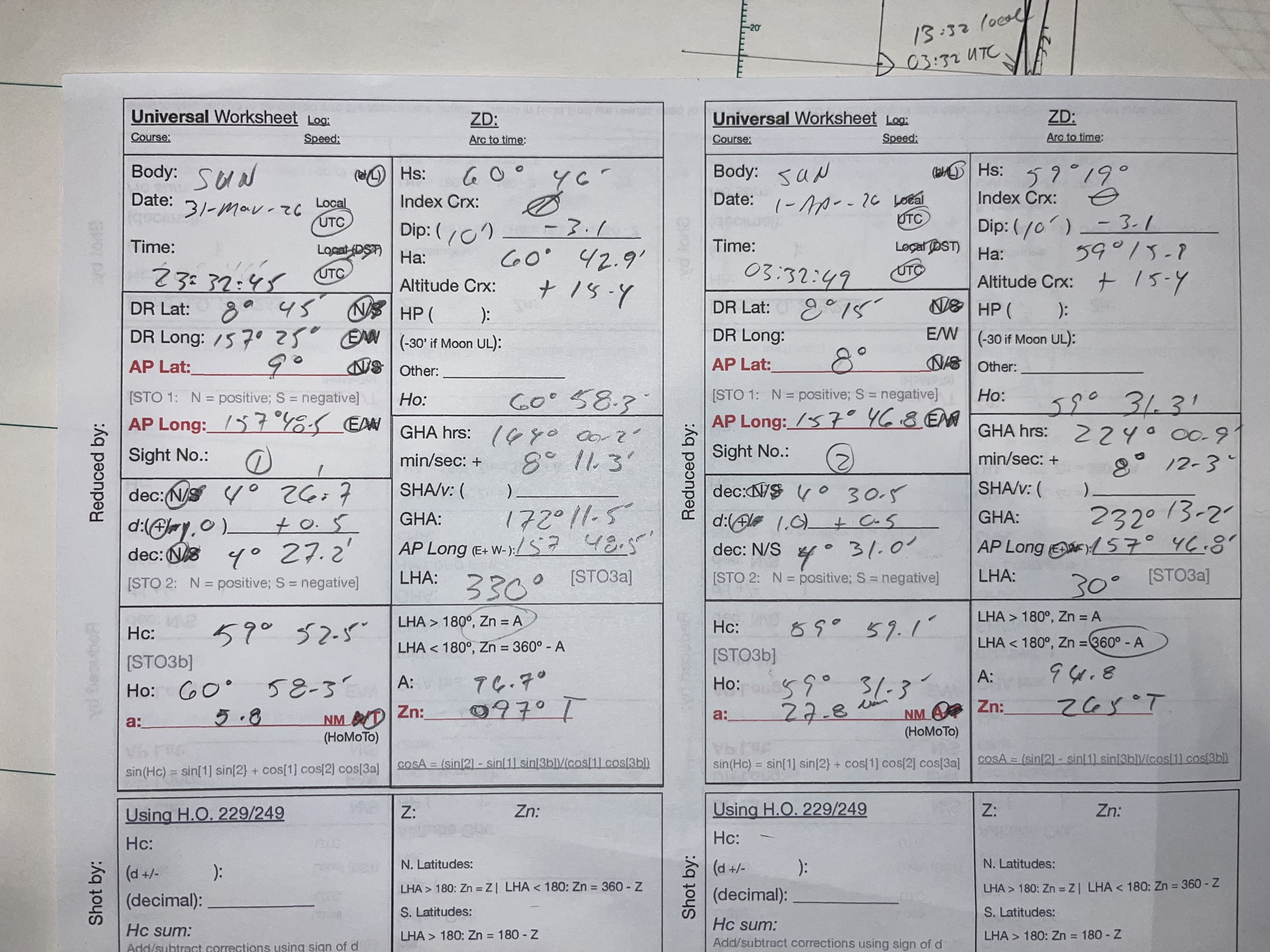
You shoot the sun about an hour and a half later, which gives you an LOP that seems to be a good deal further east than you expected.
OK, carrying on at 180° True at 6 kts... you shoot the sun again four hours later, perhaps hoping to get a reasonable Lat/Long from the paired sun shots for LAN? Were you thinking the first shot was 2 hours before LAN and the second about two hours after LAN? If so, you expected the two Hs's to be about the same, but whoops, they're not.
You plot that second LOP anyway and advance your earlier LOP to get a really rough latitude of 8° 10' N at the time of the second shot.
Pohnpei, whose tallest peak is 2,566 feet above sea level, should just become visible about 60 miles away, give or take. To get that, you multiplied the square root of that height by 1.17 to get the distance in nautical miles from the horizon one would see from the top. Then you added the dip of your own height of eye of maybe 10 feet. The result is a little more than 60 nautical miles.
At 60 miles out, I think you might must be able to see the tippy top of the island to the south just as the last rays of sun dim about 18:30 local time, or five hours after your last sun shot. That's assuming good visibility and that you continue heading 180° T at 6 kts.
Is any of that even roughly right???
And Josh, thanks for the diversion here. I'm recovering from knee surgery and am pinned to my chair for weeks with precious little to do.