NavList:
A Community Devoted to the Preservation and Practice of Celestial Navigation and Other Methods of Traditional Wayfinding
Re: Cessna CN Summary
From: UNK
Date: 2010 Jan 13, 13:49 -0800
From: UNK
Date: 2010 Jan 13, 13:49 -0800
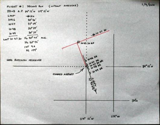
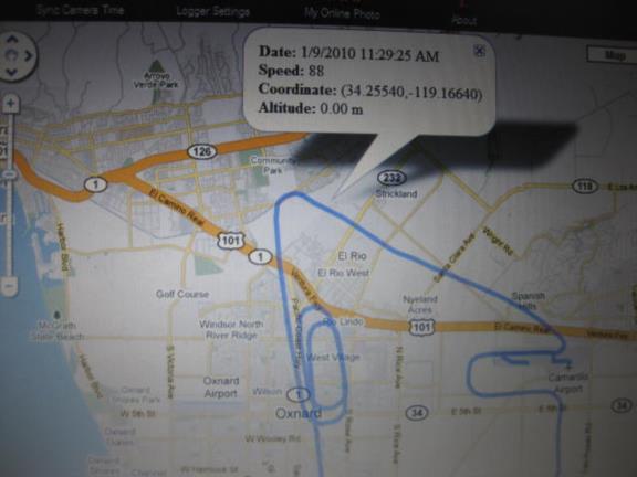
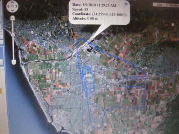
These sights were worked without allowing for Coriolis. The formula for calculating the Coriolis correction is 0262 times the ground speed in knots times the sine of the latitude. We flew at 90 knots so the maximum correction would be 2.4 NM for sights taken at a latitude of 90 ° (sine = 1), over the poles but the latitude of the flights was 34° (sine = .56) so the Coriolis correction on our flight is only 1.3 NM which we would use to move the fix or the individual LOPs 1.3 NM to the right of our track. This correction can also be applied to the individual LOPs by multiplying the Coriolis correcion by the sine of the relative azimuth. If the sun is directly in front of the plane then its LOP would be shifted to the right by 1.3 NM but since it is moving in the direction that the LOP is already plotted it is merely slid along its own axis so there is no change in the placement of such an LOP. I manoevered the plane so that the sun was straight in front of us ( within 5 degrees) so the Coriolis correction would be only .1' shifting the LOP only 0.1 NM so we can just ignore Coriolis for these shots. But there was one shot taken through the back window while the plane was on a track of about 330 ° while the azimuth of the sun was 170° creating a relative azimuth of 160° . This was taken at 19:29:26 Z so the correction for this sight is .5' (or 0.5 NM) which can be applied to the computed altitude or to the observed altitude or to the intercept, you get the same LOP either way. Since the sun was off to the left when this sight was taken the sign of the correction is plus if applied to the Hc and negative if applied to the Hs. Applying this correction to the single shot taken through the back window by Greg it makes that intercept only 21.5 NM instead the 22 NM that Greg posted, a little bit of an improvement. I am attaching two photos of my computer screen running the photo trackr software that is normally used with the GPS data logger. This shows the ground track one either a Google Map or Google Earth background. I am also attaching a short video showing an animation of our plane's movement while Greg took this shot. gl gl gregrudzinski@yahoo.com wrote: > > Three Flights Completed > > Five Sun observations performed using a two minute averager > ( Intercepts of 2A, 3A, 8A, 10A, 18A ) > > Six individual observations performed with four consecutively averaged. > ( Average of four 9A, Individual from back seat 22T, Individual from > front seat 19T ) > > > First Impression- The Bubble moves a great deal even though the plane > seems to be level and steady. This was most apparent when the horizon > prism was flipped in on the MK 5 where the bubble movement could be > seen relative to the horizon. In spite of this reasonable accuracy was > still obtained. Clearly there would have been no problem finding an > island such as Anacapa (6NM long) with or without an averager but > given the choice I would go with the averager. > > Greg Rudzinski > > > ---------------------------------------------------------------- > NavList message boards and member settings: www.navlist.net/NavList > Members may optionally receive posts by email. > To cancel email delivery, send a message to NoMail[at]navlist.net > ---------------------------------------------------------------- > > >


