NavList:
A Community Devoted to the Preservation and Practice of Celestial Navigation and Other Methods of Traditional Wayfinding
From: David Pike
Date: 2022 Jul 24, 09:35 -0700
Stuart T you wrote: I recently came across this sun compass by Sir Chichester and thought it was interesting. The one thing that I can't figure out is the the following description, "It is designed for use anywhere in the world within 200 miles north and south of a line from Birmingham to Berlin." 200 mi N/S seems like it would be of limited use. I am assuming they are referring to lattitude? Am I reading this incorrectly?
Has anyone ever used one of these sun compasses?
Stuart
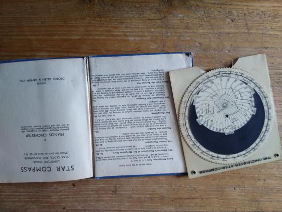
1944 Birmingham to Berlin says it all. It’s just a topical touch of marketing to say the graphics are drawn for 52.5° North and that it remains acute between 50°N and 55°N. In 1944 Chichester was still working for the RAF but was obviously beginning to consider how he was going to earn a living when the war was over. Those familiar with geography would have known that Birmingham and Berlin were both situated around 52.5°N. The public in the UK following the daily BBC Bomber Command news announcements would be familiar with Berlin. Its big brother, the Chichester ‘Star Compass’ came along in 1945. That was also drawn for 52.5°N as no doubt were other planispheres published in the UK. Any enterprising entrepreneur could have redrawn the graphics for a different latitude. USAF star identifiers have a series of acetate or celluloid discs to cover several latitudes, but materials in the UK were either still rationed or in short supply. £105, wow! I don’t recall paying more that £10 for my 'Star Compass' in 2005 including p&p. In 1944 you could have bought it for 5s, but that would also have bought you 30 pints of beer. No I've never used one seriously, only in my head using 15°/hr. DaveP


