NavList:
A Community Devoted to the Preservation and Practice of Celestial Navigation and Other Methods of Traditional Wayfinding
From: Lars Bergman
Date: 2024 Jan 17, 07:57 -0800
Recently, Frank wrote, in connection with high-power scopes: "this do-it-yourself chronometer rating was a nice trick to have in the bag of tricks, and a good high-magnification scope was a helpful tool in that role. There's at least some logbook evidence that some navigators did this in the late 19th century. Note that this was not necessary in major ports. If you landed in Liverpool or Lisbon, you could take your chronometer to a clock shop and have it regulated".
First I would dare to say that no one took his chronometer to a clock shop for any other reason than repair, or regular service. Moving a chronometer will likely affect its rate and is thus to be avoided. Instead a portable watch could be used, compared with the chronometer before being taken ashore, then compared with the correct time, and at last again compared with the chronometer when back on board; after as short time ashore as possible.
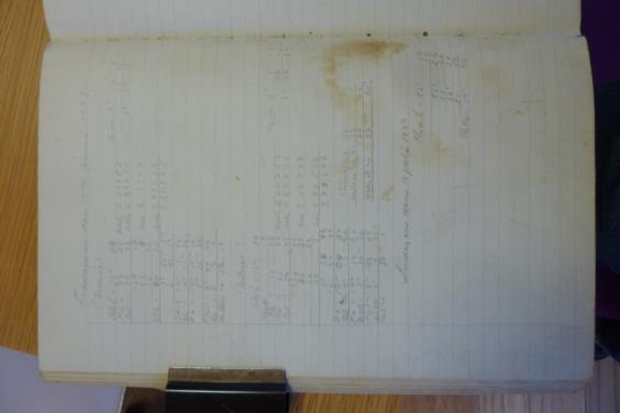
Chronometer ratings at sea were performed whenever a good opportunity arised. I have seen examples in logbooks of ratings off Madeira, off Fernando Noronha, in La Plata, and other places. A good example is attached. It is from the ship Grace Harwar on a voyage from Wallaroo in South Australia towards Queenstown (today Cobh, Ireland) for orders, with a cargo of wheat. On the 58th day out from Wallaroo, 14 June 1929, at 4:30 pm they were in sight of Staten Island and able to determine their position by bearings to shore: latitude S 54°43', longitude W 63°20'.
The raw altitude of Sirius (in WNW) was 36°4' at chronometer time 8h7m7s.
The raw altitude of Antares (in ESE) was 18°29' at 8h9m46s.
The index correction is not known but is probably incorporated in the noted altitude. The height of eye is somewhere around 6 meters, but is not very critical to the result. There are a couple of errors in the attached calculations but the averaged result, 37m20s slow, seems to be less than 20s off, or less than 5 minutes in longitude.
Lars


