NavList:
A Community Devoted to the Preservation and Practice of Celestial Navigation and Other Methods of Traditional Wayfinding
Re: Compare Methods: Lat/Lon Near Noon
From: Luc Desmedt
Date: 2021 Sep 8, 04:11 -0700
From: Luc Desmedt
Date: 2021 Sep 8, 04:11 -0700
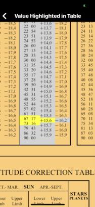
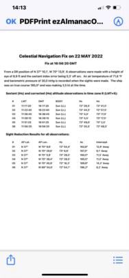
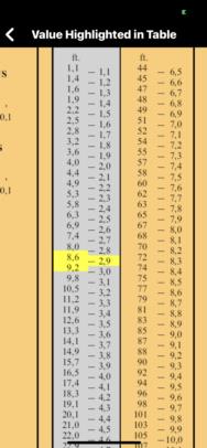
hello, i started by finding eye level, with + 15.6 first yellow page correction, and i'm reading Dip + SD 12.7 IC +0.3 total +13. I do 15.9-13 = 2.9 Ht of the corrective eye for a height of 9 ft
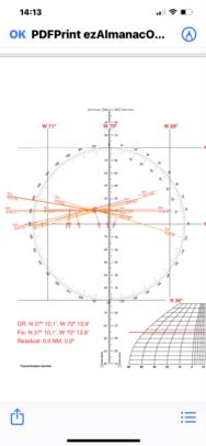
I have to decide the latitude of the universal plotting sheet, the highest measurement is 73 ° 04.5 'I calculate the zenith distance 90 ° -73 ° 04.5' = 16 ° 55.5 '+ the declination of the sun at this moment 20 ° 28.5' + my Dz 16 ° 55.5 '= 37 ° 24.0' my plotting sheet will have a latitude of 37 °
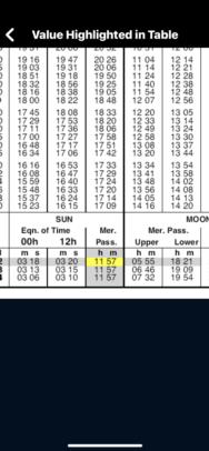
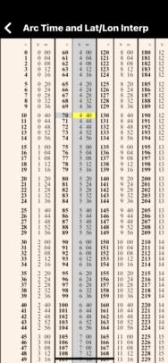
I see in the N.A that the sun passes at 11:57 UT in Greenwich, it peaked + - 04:40 later on my local meridian I centered my longitude on 70 ° W
from the estimated position DR Long 70 ° W / DR Lat 37 ° I can enter the calculations.
