NavList:
A Community Devoted to the Preservation and Practice of Celestial Navigation and Other Methods of Traditional Wayfinding
Re: Compass History
From: Don Seltzer
Date: 2023 Nov 19, 22:54 -0500

From: Don Seltzer
Date: 2023 Nov 19, 22:54 -0500
At least as far back as the mid-1700's, mariner's compasses were marked both ways.
From William Falconer's 1769 Dictionary of the Marine:
COMPASS, an instrument employed to determine the ship’s course
at sea, and consisting of a card and two boxes. The card, which is calculated
to represent the horizon, is a circle divided into thirty-two
equal parts, by lines drawn from the center to the circumference,
called points or rhumbs. The intervals between the points are also subdivided
into equal parts called degrees, 360 of which complete the
circle; and consequently the distance or angle comprehended between
any two rumbs is equal to 11°, 15´...
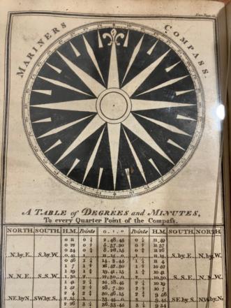
Attached is an illustration from Moore's 1814 Practical Navigator.
Don Seltzer


