NavList:
A Community Devoted to the Preservation and Practice of Celestial Navigation and Other Methods of Traditional Wayfinding
From: Bill Lionheart
Date: 2017 Jan 19, 10:10 +0000
I have often, to mathematics students, given the intercept method as an example of the first iteration of Newton's method for solving a system of two equations on a surface, and implied at least (without any historical verification) that it was an example of the same solution occurring independently in different applications of mathematics. It never really occurred to me that if you were really lost and your AP was way off you might try more iterations, or indeed what is the radius of convergence.
Sumner's method for lop solved a "time sight" twice for longitude using 2 different latitudes that differed only by a small amount - Frank suggests 0.1 deg. Plotting the 2 positions and drawing a straight line between them gives us a chord of the circle of position (cop) corresponding to the measured altitude. Marc St Hilaire's intercept method for lop gives us a distance between 2 cops one thru the ap and one corresponding to the measured altitude. With St Hilaire's method we also calculate the azimuth from the ap to draw the tangent to the cop corresponding to the measured altitude at the point where it intersects the azimuth line. Both methods give a good approximation to the same cop.
We also have modified Sumner methods that solve the time sight for longitude and also the azimuth from that position. The resulting lop plotted thru that tangent to the azimuth would also approximate the cop thru the one position found. In fact it would be the same lop found by the St Hilaire method if the ap was the position found by time sight. Lops found by these methods were all called Sumner lines.
This afternoon, for want of a better thing to do, I was quietly browsing the text of
Tables for Azimuths, Great Circle Sailing and Reduction To The Meridian with Improved "Sumner" and Marq St. Hilaire Method. Also an Improved Traverse Table And Other Useful Navigational Works by H. S. Blackburne (1923).
Sorry.......I could not resist writing the book name in full (-;
Later I started browsing the Navlist archives and by chance found this thread.
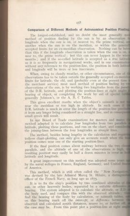
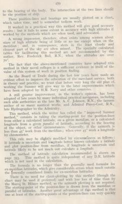
Blackburne seems frustrated that although the Royal Navy used the intercept method the merchant navy clung on to the Sumner method. What also annoyed Blackburne was that the Board of Trade examinations used the Sumner's original time consuming long/long method rather than the modified long/azimuth method.
Blackburne describes an "Improved Sumner Method" in which either a latitude is assumed and a long calculated or a long is assumed and a lat calculated. Which way it was done depended on whether the mariner was more certain of his lat or his long.
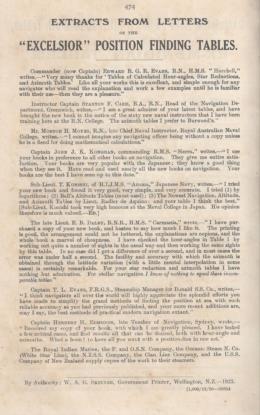
What is particularly interesting is that although Blackburne considers the "New Navigation" a great improvement he continues to promote Sumner methods. The cynic in me says that is because he had devoted a significant proportion of his off-duty hours to calculating his tables and naturally he wanted to sell his books. Blackburne's books include many pages of testimonials from both RN and merchant navy officers. I have attached an example.
As an aside I note that the W. A. G. Skinner, the NZ Govt printer produced 1,000 copies of this printing.
Attached File:
Attached File:
Attached File:
--
http://www.maths.manchester.ac.uk/bl


