NavList:
A Community Devoted to the Preservation and Practice of Celestial Navigation and Other Methods of Traditional Wayfinding
From: Frank Reed
Date: 2020 Oct 6, 11:09 -0700
There are tables in various navigation manuals that will tell you the distance of a mountain peak or maybe a vessel when you measure the angular height of that portion of it peeking up from behind the horizon. These tables and their explanations have been wrapped in mystery and often confused by long-running errors. In my "Office Hours" session on Sunday, I spent some time on a little presentation trying to explain where the tables and equations originate and also, I hope, demonstrating their reasonable limit.
I'll start this thread off with a scenario and an image to get you thinking...
You are "shipwrecked" on an unihabited island paradise in the western Caribbean. You have lots of great books to read (and you haven't yet had that "Twilight Zone" moment where you break your reading glasses). There's lots of fresh water trapped in plastic bottles (trash) washed up in the wrackline. But food is running out. You have just finished roasting the last delicious lizard on the island. The island's cockroach population, formerly kept in check by the lizards, is booming, and paradise is getting pretty annoying. So you scan the horizon for ships, hoping to hitch a ride back to good old civilzation...
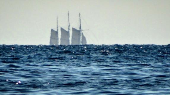
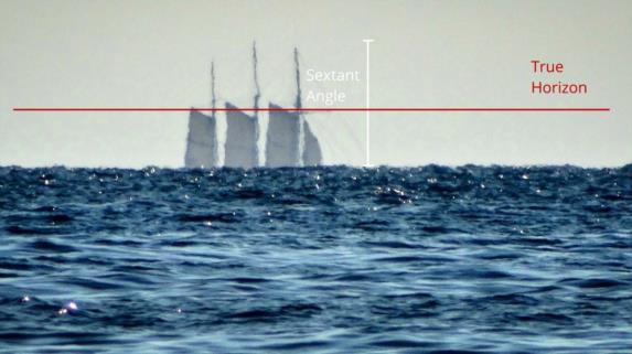
You have a sextant with you with a good 7x scope on it, and on the horizon you spot a three-masted ship. It's a cruise for well-heeled tourists. In fact, you know this vessel! It is the SS Botany Buoy, and you happen to know that the top of its mainmast stands 105 feet above the waterline. With your sextant, you measure the angle from the sea horizon (which is in front of the lower portion of the vessel visually), and you hope to determine how far away it is before you start burning down the last tree on the island for a signal.
Here is what you see...
[more in the next message]
Frank Reed


