Welcome to the NavList Message Boards.

NavList:

A Community Devoted to the Preservation and Practice of Celestial Navigation and Other Methods of Traditional Wayfinding

Compose Your Message

Message:αβγ
Message:abc
Add Images & Files
    Name or NavList Code:
    Email:
       
    Reply
    Re: Earhart news story
    From: Noell Wilson
    Date: 2024 Feb 4, 05:48 -0800

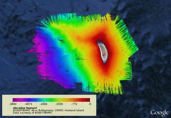
    Frank, I agree. I saw the "depth?" Question go begging several times and thought I'd throw something out to start that conversation. I looked for dates in the Atlas and didn't find anything in the first 10 pages or so. I used a graph that changed to "data projections" to justify my "circa 2010".

    I found depth readings for a few "Island lengths" around Howland but that was too small an area. https://www.pacioos.hawaii.edu/metadata/pibhmc_bathy_40m_howland.html

    Google Earth seems a better source - depending on which data they used. 
    regards, Noell
    File:


    Reply
    Browse Files

    Drop Files

    NavList

    What is NavList?

    Get a NavList ID Code

    Name:
    (please, no nicknames or handles)
    Email:
    Do you want to receive all group messages by email?
    Yes No

    A NavList ID Code guarantees your identity in NavList posts and allows faster posting of messages.

    Retrieve a NavList ID Code

    Enter the email address associated with your NavList messages. Your NavList code will be emailed to you immediately.
    Email:

    Email Settings

    NavList ID Code:

    Custom Index

    Subject:
    Author:
    Start date: (yyyymm dd)
    End date: (yyyymm dd)

    Visit this site
    Visit this site
    Visit this site
    Visit this site
    Visit this site
    Visit this site