NavList:
A Community Devoted to the Preservation and Practice of Celestial Navigation and Other Methods of Traditional Wayfinding
From: David C
Date: 2016 Dec 8, 23:18 -0800
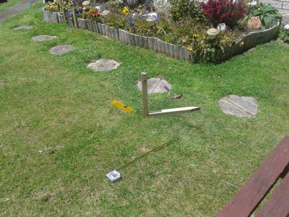
Just before LAN today I became lost and needed to perform a meridian altitude sight. Such sights with an AH are not possible for me at this time of year so I had to improvise. I had with me some pegs, a tape measure, a level, a tablet containing the aeronautical almanac and a calculator. See the photo. With only a minimal effort to level the pegs I obtained the following result:
2016/12/9
130803 (approx)
Zone -13
Vertical 370 mm
Horizontal 121 mm
Angle 71° 53.5'
Refraction 0 (from AP3270)
Sun's altitude 71° 53.5'
dec 22° 49.9'
lat = 90 + dec - alt
= 40° 56.4'
GPS lat S 41° 06.5'
Error 10.1' which I am happy with considering the very rough way in which I levelled the pegs and measured the lengths. Probably accurate enough to get me out of the Sahara?


