NavList:
A Community Devoted to the Preservation and Practice of Celestial Navigation and Other Methods of Traditional Wayfinding
From: Al Stewart
Date: 2022 Jun 20, 08:53 -0700
All good, Joe!
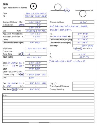
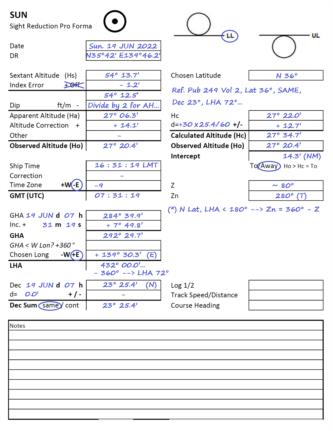
For my regular practice sights, I use the Excel spreadsheet to compute altitude from my actual GPS location, which allows me to check the accuracy / quality of my sextant sights. I also prefer to take multiple sights (say 3 to 5), average the results (time and Hs) and use the average for the sight reduction. For practice, I also carry out the conventional sight reduction using an Assumed Position and Pub 249 tables.
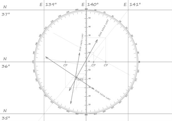
In terms of the actual sight reduction and plot, the LOP will be determined by your actual sextant measurement, and then by careful sight reduction process. I like to note all the steps on the form to avoid errors, and have attached the completed sight forms and plot.
I am curious - what sextant were you using to take the 01:15:25 UTC sight? Most marine sextants have a measurement range slightly above 120°, say up to ~126° or so... your recorded sextant altitude Hs = 134° 37.1’ is not possible with any of mine!
Yours aye,
Al Stewart
Jamaica


