NavList:
A Community Devoted to the Preservation and Practice of Celestial Navigation and Other Methods of Traditional Wayfinding
Re: GPS System failure
From: Greg R_
Date: 2014 Jun 17, 14:56 -0700
From: Greg R_
Date: 2014 Jun 17, 14:56 -0700
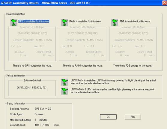
It dawns on me that the trainer for the Garmin
aviation GPS units has an FDE (Fault Detection and Exclusion) feature that can
be used to predict GPS availability for a given place and time.
If you can send me the date and time (including
timezone offset from GMT) that your outage occurred, plus the approximate
latitude and longitude I can build a waypoint from that location and then run
that data through it and see what it says (if you know the names of any airports
in the vicinity that would be helpful, too - since I'll need to build a flight
plan for it to work with).
The fact that they are all different makes/models
would seem to rule out a systemic manufacturer failure - it's looking more and
more like the satellite geometry just wasn't optimal for that half hour or
so.
--
GregR
----- Original Message -----From: Jeremy CSent: Tuesday, June 17, 2014 1:26 AMSubject: [NavList] Re: GPS System failureThey are all independent units. So they all have their own antennas/coax/etc. Power was not an issue either.
I am not familiar with RAIM, but if it costs more, I don't have it. All three were also different makes/models. Once the signal was lost, it went into "sky scan" mode and didn't pick up any birds.
I can't see it being interference, or the GLONASS birds would probably have disappeared as well.
I am getting DGPS signals here, so there is correction.
Fortunately I was at anchor and it wasn't too big a deal, but just a bit strange. It isn't so much the loss of positioning, it's the fact that a loss of GPS on here means the loss of comms gear and endless alarms from various equipment.
Jeremy


