NavList:
A Community Devoted to the Preservation and Practice of Celestial Navigation and Other Methods of Traditional Wayfinding
From: Sean C
Date: 2019 Jan 10, 22:25 -0800
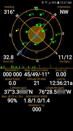
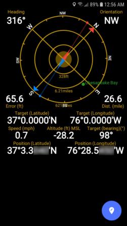
I use an app called "GPS Status and Toolbox". In addition to showing the GPS time (labeled as "Last Fix"), it also shows information about many of the phone's sensors AND it can be used for actual navigation. Waypoints can be set, saved and followed using an additional "radar" screen. Units can be set to a variety of different formats including decimal degrees, DMS, DM.M and even UTM, MGRS and more. If your phone has temperature and/or pressure sensors this info will also be displayed. Units for all sensor info can be configured for whatever format you prefer (statute mile, nautical mile, mph, km/h, knots, inHg, mb, degrees, mils, etc.) Time can be displayed in either local or universal time. There is a "night" theme with red only display. The app is split-screen capable and also has the novel ability to be minimized to a small floating "pip" (picture in picture) while you do other things on your phone.
The first screenshot below shows the default "status" screen. The second shows the "radar" screen with the mouth of the Chesapeake Bay set as a waypoint from my current location.


