NavList:
A Community Devoted to the Preservation and Practice of Celestial Navigation and Other Methods of Traditional Wayfinding
From: Mark Coady
Date: 2016 Aug 10, 19:05 -0700
Frank,
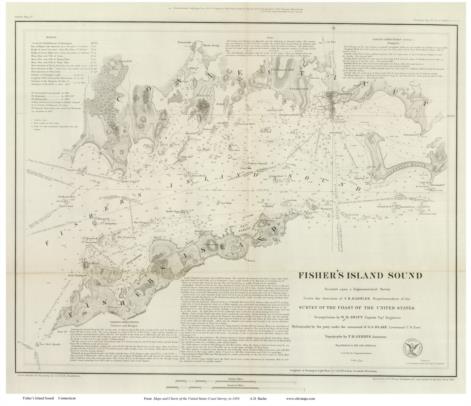
Your chart explanation brought me back to another question I was pondering and saving. I attached a jpg of an 1847 chart of fisher's island...it set me to thinking... considering this has been my home port stomping ground, off and on...since I was a child....I looked at this and was stunned to see how well defined it seemed to be...and presumably similarly accurate? I hope to print it on tracing paper and overlay it on a similarly scaled modern chart at some point. I should be able to fudge scales using the legend.
In the mid 1800's.. how much of this might have been astronomical vs surface trigonometry and surveying. How to plot a detailed depth or underwater obstruction from a floating vessel other then triangulation? I have used that with great success locating wrecks. I mean land is a challenge enough, but reefs and shoals, depths, over water... etc... must have posed quite a challenge.
My guess is they didn't have any batteries for their GPS...


