NavList:
A Community Devoted to the Preservation and Practice of Celestial Navigation and Other Methods of Traditional Wayfinding
From: Frank Reed
Date: 2018 Sep 23, 10:05 -0700
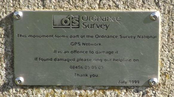
Geoffrey is right that this is something different. The marker he photographed is not just a traditional surveyor's benchmark. You can tell by zooming in on the photo as below. The sign reads "ordnance survey national GPS network", and it's dated 1999. So twenty years ago, this was "new tech". It may be obsolete, or about to become obsolete today, but at least back then, this was clearly more than just a benchmark. So we google...
I don't know anything about this system, but I can Google "ordnance survey national GPS network" and it leads me to a Wikipedia page on the system, https://en.wikipedia.org/wiki/National_GPS_Network, which informs us that this system leads to 1-2 cm accuracy in position fixes with the right equipment. As we all know, the best function of Wikipedia pages is to provide useful links to better information. The Ordnance Survey FAQ page seems especially useful, and it appears to have been updated recently.
Frank Reed


