NavList:
A Community Devoted to the Preservation and Practice of Celestial Navigation and Other Methods of Traditional Wayfinding
From: Sean C
Date: 2017 Feb 17, 16:58 -0800
Bob Goethe wrote:
"I go to Google Earth to sort out how far the shore is from me, at the compass bearing I am looking...and then I go to Bowditch to determine my dip."
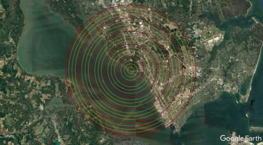
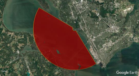
There is a handy plugin (kml) for Google Earth called "Rings" which draws range rings around a given location. You can set the starting and ending ranges, interval, line width and color for the index and sub-rings. This lets you see at a glance how far various features are from your chosen sighting location for a full 360°. The plugin will also draw an annulus, disk or sector. The sector dialogue allows you to choose the starting and ending azimuth.
To install the kml:
1) Download it from the link above.
2) Open Google Earth.
3) Click the "File" menu and select "Open...".
4) Navigate to where you saved the file.
5) Highlight it and click the "Open" button. (Or just double-click the file.)
Attached are two examples showing the spot from which I usually take sights. The first shows rings set at an index (red) of one nm out to 5 nm, with sub-rings (orange) set at 0.25 nm. The second shows a sector of 0.25 to 5 nm for azimuths 148.7° to 300.7° (the effective range I have to take sights).
Cheers,
Sean C.


