NavList:
A Community Devoted to the Preservation and Practice of Celestial Navigation and Other Methods of Traditional Wayfinding
Re: Gnomonic Charts - Usable Zones
From: Andrés Ruiz
Date: 2018 Jan 22, 19:14 +0100
From: Andrés Ruiz
Date: 2018 Jan 22, 19:14 +0100
Hello Stan, air navigation also used GC sailing!
Nowadays practical use of gnomonic charts is nearly over...
nobody improvises a GC route on the fly.
My program, and others, can export the GC/Composite sailing data in GPX format, to be used on an ECS, ...
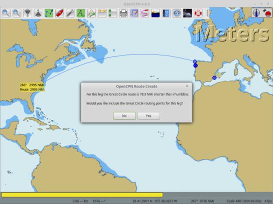
Also OpenCPN has a built in tool to plot GC and obtain RL waypoints, (attached).
yes method 2.
Link Here is broken: http://celestialtools.webs.com/downloads
Celestial Tools V5.5.0 (the executable as a 514KB RAR archive, released version dated 3/21/2017)
I got 560 from http://www.usps.org/eddept/n/tools.htm#celtools
Link Here is broken: http://celestialtools.webs.com/downloads
Celestial Tools V5.5.0 (the executable as a 514KB RAR archive, released version dated 3/21/2017)
I got 560 from http://www.usps.org/eddept/n/tools.htm#celtools
regards!
--


