NavList:
A Community Devoted to the Preservation and Practice of Celestial Navigation and Other Methods of Traditional Wayfinding
From: Frank Reed
Date: 2018 Jan 18, 19:09 -0800
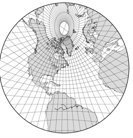
If it's projected correctly, which you can generally assume to be the case, it's valid everywhere covered by the chart: great circles are mapped to straight lines. And don't forget that you can validate this for yourself by picking up a common globe and pulling a string across the surface. The great circle you find that way will match the great circle that you find on a gnomonic chart. It's also worth noting that you can ignore the continents.displayed in gnomonic charts and apply them to any part of the globe. The example you have posted:
covers the area from about 20°S to the north pole and beyond, and from about the prime meridian to 120°W and beyond. If you need the great circle from 10°N, 40°W to 50°S, 60°E, it may appear that you're off the chart. But you can do that case on the same gnomonic chart. Swap N for S --that's easy. Then shift all the longitudes 60° to the west. That surrogate great circle problem starts at 10°S, 100°W and ends at 50°N, 0°. So you draw your straight line between those two points, pick off waypoints at every 5°-10° or so, and then when you have that list of points, reverse the earlier substitution: swap S for N and shift all the longitudes 60° east. One gnomonic chart to rule them all.
Frank Reed


