NavList:
A Community Devoted to the Preservation and Practice of Celestial Navigation and Other Methods of Traditional Wayfinding
From: Doug MacPherson
Date: 2014 Dec 30, 10:38 -0800
David:
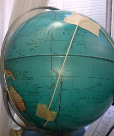
Thanks for the Challenge. I chose to take the non-electronic "route". First, a cursory look at my analog computer (the aluminum grade school globe) reasonably assured me that the route would be clear of land. The Globe shows the distance to be 2218 (statute miles I believe) from New Zeeland to Pago Pago, and another 2250 from Pago Pago to Honolulu with an intitial bearing some where between 000˚ and 045˚. (See attachment 2) It looks like a stop in the Fiji Islands might be in order :)
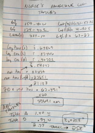
For a little more precision, I pulled out my copy of Norie's Nautical Tables and using the Log and Haversine tables solved the spherical triangle yielding a distance of 4069 nm. The ABC tables yielded a Zn of 26˚ which appears to make sense with what the globe shows. (see attachment 1) Took me about 20 minutes to get to the solution; half the time trying to remember how to do it.
Have a great New Year!
Doug
38˚34.3' N, 121˚ 28.5 W


