NavList:
A Community Devoted to the Preservation and Practice of Celestial Navigation and Other Methods of Traditional Wayfinding
From: David C
Date: 2020 Apr 18, 19:46 -0700
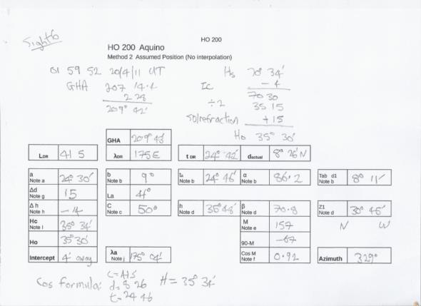
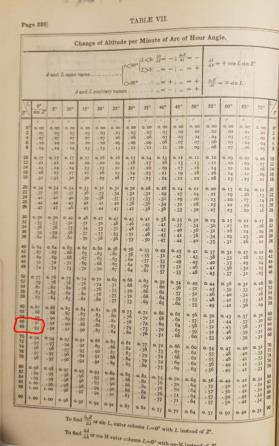
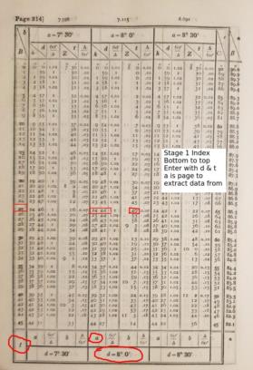
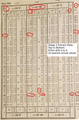
Included in HO 200 are a set of alitude-azimuth tables based on Aquino. I had successfully worked sights using Dreisonstok and Hughes (both tables are very similar) and decided that an easy next step would be to use Aquino. How wrong I was! Several frustrating days later I completed the task.
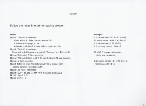
Although HO200 was published in 1928 it follows the 19th century convention of giving examples in dense, lengthy text, something the 21st century mind finds difficult to understand. Then the explanation contains the phrase "The manner in which a and b must be combined to give M is shown in the precepts". What precepts? Where are they?
But what confused me the most was not the above. It was how Aquino deals with assumed longitudes. If you follow the Dreisonstok/Hughes method and start with an assumed longitude you will get the wrong answer. It will differ from the cos formula solution by a few moa. I seriously though that there was an error in the tables. Using formulae I found in a book by Aquino I calculated some of the table entries. The table entries were correct.
The explanation is that you must enter the tables with the DR hour angle (t) rounded to the nearest degree. The result is h, Z and the assumed hour angle. Using the latter in the cos formula gives the correct value of h. The assumed longitude can also be computed from this number. The assumed hour angle is *not* rounded to the nearest 30' as you would do manually.
A minor nuisance is that two two-digit numbers must be multiplied. Did the mariners of old do it by long multiplication?
In azimuth tables there are two methods of naming Z - relative to the bearing or the elevated pole. Aquino uses the bearing so in south lat with a PM sight Z = N 31 W = 329°. In contrast Hughes, Dreisonstok, Burdwood and Davis use the elevated pole method. The above would be S 149 W = 329°.
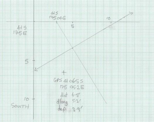
I have plotted the LOP on a plain chart The LOP is about 2' from the gps (oops! gnss) position.
According to the weather forecast there will be clear skies in six days time. I may spend that day taking sights with the aid of the anti-spoof app. Then I will reduce the sights with Aquino and plot them. Hoping for a small cocked hat......
