NavList:
A Community Devoted to the Preservation and Practice of Celestial Navigation and Other Methods of Traditional Wayfinding
From: David Pike
Date: 2022 Dec 2, 20:24 -0800
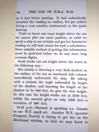
You maritime navigators strive desperately for accuracy. An air navigator would say "How wrong must I be for it to matter?" The funny thing is, the higher you are with a marine sextant the less the effect of one metre's height error. Check the dip tables. Unfortunately, the higher you are the greater the error in your height measurement is likely to be, so it probably cancels out. The dip tables work very well up to the height where the distance to the sea horizon approaches the visibility limit. In the days when the bubble sextant was in its infancy, aviators used marine sextants. Calculating dip became a problem on long sea legs if you were using a pressure altimeter to measure height, because bereft of good communications, you had little idea of what sea level pressure to set on your altimeter. One method of finding it was to descend until you were almost touching the waves and reset the sea level pressure adding 1mb per estimated 30 feet. On a sunny day, airship navigators had it easy, because they could simply measure the angle between the bow and stern of their shadow and knowing the length of their airship and the fact that the Sun's rays are parallel, they could work out their true height above the sea*. DaveP
* The Log of H.M.A R34 to America and Back (in 1919) E. M. Maitland 1920. They had three sextants (two in the cabins and one in the roof) and one bubble sextant.


