NavList:
A Community Devoted to the Preservation and Practice of Celestial Navigation and Other Methods of Traditional Wayfinding
From: Frank Reed
Date: 2023 Dec 11, 16:33 -0800
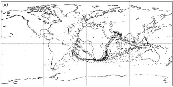
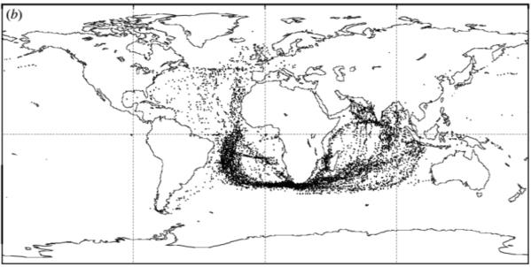
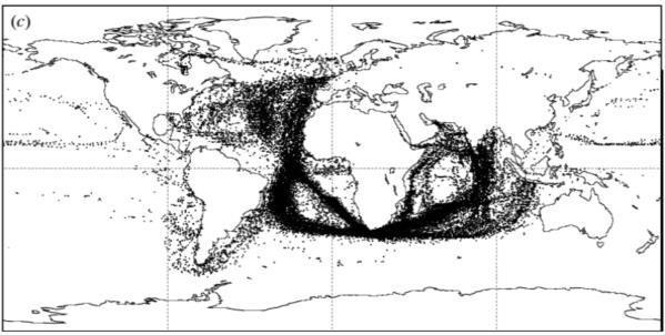
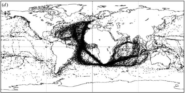
I mentioned in my last post that the magnetic declination date is "only approximate in the earliest period". The model of the magnetic field used to generate those historical isogonic charts is largely based on ships' logbooks. It was normal to measure magnetic declination (compass variation) on a daily basis or whenever practical by checking Sun amplitudes or other astronomical indications of true azimuth against the magnetic compass. These results were recorded, and if they also include a reasonably accurate position, they are data points that can be used to model the magnetic field. Of course there are many sources of uncertainty in this process, and also the data is limited to the areas where vessels from northwest Europe actually sailed and kept logbooks. The maps I'm attaching here show the voyage track points that were used for the four fifty-year periods beginning in 1600, 1650, 1700, and 1750. You can read about the complex, labor-intensive process that led to this magnetic model here:
https://royalsocietypublishing.org/doi/epdf/10.1098/rsta.2000.0569.
The analysis from logbooks covers the period from early European voyages in the late 16th century through the end of the 19th century. Years after 1900 are generally covered by modern scientific models of the geomagnetic field, and these are more reliable. The two techniques do not quite match up at the year 1900. So they average! They ran a weighted average transition from the logbook-derived model to the modern geomagnetic model as noted here.
Frank Reed


