NavList:
A Community Devoted to the Preservation and Practice of Celestial Navigation and Other Methods of Traditional Wayfinding


From: Frank Reed
Date: 2026 Nov 5, 15:40 -0800
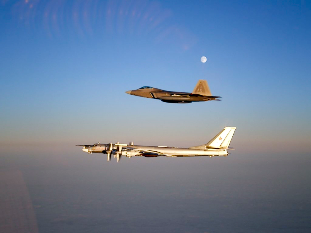
This is just a fun angles puzzle. The goal of the puzzle is simple: What is the date? And how far away are the two aircraft? Two details: the location is somewhere above or near-above Anchorage, Alaska. And the month is November, 2007.
Rules of the game. You can cheat all day long. If you want, dig up the image using a photo recognition tool like "Google Images" (currently this is still superior to most consumer-grade AI tools which settle too quickly on rough matches). But you get no points for giving the answer based on cheating! Use some astronomy / celestial navigation and some math and describe how you get there. How can you judge the date from this photo and the additional information? And how do you determine the distance to the two aircraft? It is, of course, fair game to identify the type of the two aircraft and look up any information you need about them.
Frank Reed