NavList:
A Community Devoted to the Preservation and Practice of Celestial Navigation and Other Methods of Traditional Wayfinding
From: Tom Sult
Date: 2016 Sep 23, 18:01 -0500
Tom Sult, MD
John,
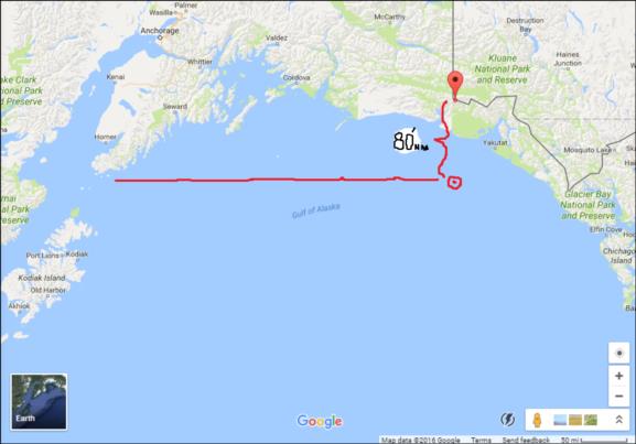
Going back to the early 80s I remember taking a vertical angle off Mt. St. Elias (18000 ft) from a height of eye of 25 ft. A distance off was obtained by a vertacle sextant angle and calculated by the DTO function on a Tamaya NC 77. We were headed due east to Homer at the time. If the distance were 80 NM then the sextant reading would have been 1° 40'. I don't recall the exact distance just that the distance off crossed will Loran C. I seem to remember being surprised that a mountain peak could be seen that far away.
Greg Rudzinski
From: John D. Howard
Date: 2016 Sep 23, 14:23 -0700My question to sailors: how far offshore can you see land?
Now I am aware of dip, visible horizon, Bowditch tables of range, etc but I have no personal experiance to draw upon. I have see the white clifits of Dover from France - about 25 miles or so but that is about It. My question is not about seeing a low lying atoll like Canton Is. but something like California with the Sanata Monica Mts. at 8000 ft or the Big Island with a 13000 ft. volcano. Can you really see it from 100 NM out?
I have the book "Hawaii by Sextant" and have worked all the cel nav sights but the last cell nav was done over 100 NM from Maui. Could the crew really sea land a full day before landfall?
Sorry if this sounds silly but I flew airplanes most of my life and I know what I saw out my cockpit was nothing like what a sailor sees.
John H.
Attached File:


