NavList:
A Community Devoted to the Preservation and Practice of Celestial Navigation and Other Methods of Traditional Wayfinding
From: Doug Faunt
Date: 2021 Dec 31, 11:08 -0800
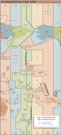
There will be plenty of chatter today about the international date line. The Wikipedia article has one key section: https://en.wikipedia.org/wiki/International_Date_Line#Cartographic_practice_and_convention. Bottom line: the nautical date line is just 180° of longitude. That's what one is expected to use at sea (but it's really up to the captain, etc.), and that practice pre-dates the international agreements usually cited. You cross 180° heading west, you drop a day from your log... Cross it eastbound, you repeat a day. The famously contorted date line that we have seen on numerous maps and globes, like the one attached below, does not exist. It has no formal status. It is a mapmakers' convenience, a crude representation of the local laws in various island groups in the Pacific. Its borders are not official by any measure, and they are in many ways misleading.
Frank Reed


