NavList:
A Community Devoted to the Preservation and Practice of Celestial Navigation and Other Methods of Traditional Wayfinding
From: David Pike
Date: 2023 Sep 22, 10:51 -0700
David McN
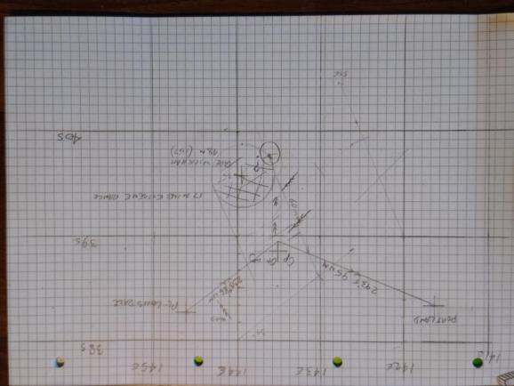
You didn’t give your bearing from Cape Wickham; your noon latitude; or your GPS position, so I had to do a bit of guessing. If Wickham Lt is 157ft high and your height of eye is about 6ft you can’t be more than 17 miles away from it, probably much less. If you’re 60 miles SSE of planned track, that puts you in the shaded area, probably in the SE sector. An air navigator would make best use of what he already has. A ‘snap’ alteration in track of about 20 degrees starboard is required. Your original track required (TR) was 293, so your new TR is 313. The wind is now abaft the beam, so there’s not much leeway, say 2 degrees starboard, so make your new course 301(T), Variation in the area is about 11degrees(E), so steer 290(M) (nice and easy to see on the compass), sorry about the rolling. The distance is about 1/3 further than the 95nm from Cape Otway to Portland, 95+32=127nm. 127nm at 5kts say is 25+2/5 hrs = 25hrs 24min.
Then sit back and wait for Australia to hove into view. If that’s two full tides, it might even work. See photo. If it comes out upside down, it’s because I drew it in the northern hemisphere. I’m afraid my chartwork falls into the ‘Messy Nav’ category. Sorry! DaveP


