NavList:
A Community Devoted to the Preservation and Practice of Celestial Navigation and Other Methods of Traditional Wayfinding
From: David Pike
Date: 2023 Sep 24, 05:47 -0700
David McN
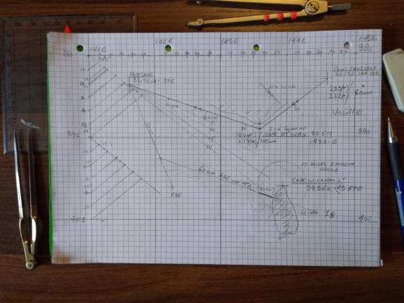
Upon re-examining my DIY Mercator Chart of the area in question, I realised it took too many liberties of Gerardus Mercator and his Chart, Mr Meridian and his Parts, and Admiral Douglas and his Protractor caused mainly by my desire to achieve best fit on a piece of A4 graph paper, lack of practice, and a couple of lapses of memory on my part.
I’ve had another go, using the ‘what to do if you fly/sail off the top/bottom of your chart method’, which is OK for small areas, but no good for large chLats of course. At least Admiral Douglas will feel happier. I’ve assumed that, with an offshore wind forecast initially, 3nm offshore would have been sufficient to round Cape Otway. I’m assuming 60nm SSE of track was an approximation, because it’s starting to put you down Sun of the lighthouse and possibly sitting on King Is. My suggestion remains unchanged. Your new track-required is about 20 degrees to starboard of the original. Lesson for DP: Use plain paper next time. It’s harder for others to spot the minor inaccuracies. DaveP


