NavList:
A Community Devoted to the Preservation and Practice of Celestial Navigation and Other Methods of Traditional Wayfinding
Re: John Karl's Celestial Navigation in the GPS Age
From: Stan K
Date: 2018 Apr 30, 20:38 -0400
From: Stan K
Date: 2018 Apr 30, 20:38 -0400
Aonghus,
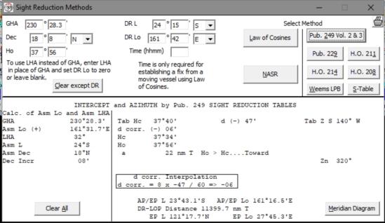
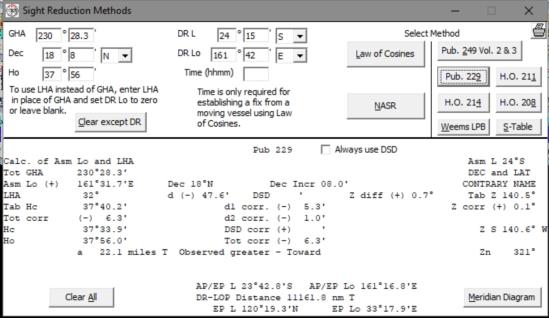
Attached are screen shots for the recently (minutes ago) corrected Celestial Tools (now V5.6.10) H.O. 249 and H.O. 229 solutions to this problem. I hope they and Celestial Tools will be of some help to you.
Stan
-----Original Message-----
From: Aonghus O Concheanainn <NoReply_Concheanainn@navlist.net>
To: slk1000 <slk1000@aol.com>
Sent: Mon, Apr 30, 2018 7:02 pm
Subject: [NavList] Re: John Karl's Celestial Navigation in the GPS Age
From: Aonghus O Concheanainn <NoReply_Concheanainn@navlist.net>
To: slk1000 <slk1000@aol.com>
Sent: Mon, Apr 30, 2018 7:02 pm
Subject: [NavList] Re: John Karl's Celestial Navigation in the GPS Age
Robert,
Thank you for prompt reply to my query.
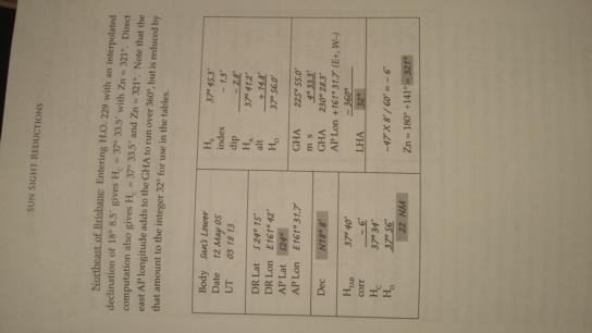
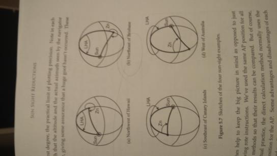
See attached photos of pages 53 & 55 from book with exercise in question. It reads 'Entering HO229 with interpolated declination of 18 degrees 8.5 minutes gives Hc = 37 degrees 33.5 minutes with Zn = 321 degrees' but I can't find this in Lat Contrary Name to Dec of HO229 for LHA = 32 degrees page, AP Lat S24 and Dec N18.
Answr is probably embarrassingly simple but I've started so I'll finish!
Aonghus.


