NavList:
A Community Devoted to the Preservation and Practice of Celestial Navigation and Other Methods of Traditional Wayfinding
From: Modris Fersters
Date: 2020 Dec 20, 13:01 -0800
In my previous post I found that I typed wrong longitude (it should be 3° 35E, not 30°35E).
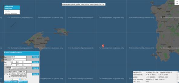
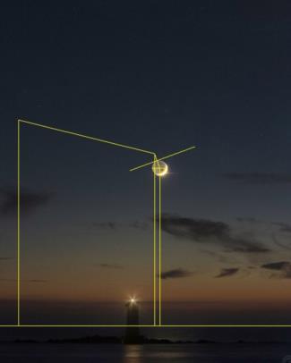
Today I tried to calculate coordinats of the lighthouse using other bodies. I measured the lunar distance between the Moon and the star 52Sgr. I took star coordinats from Stellarium. Then I cleared lunar distance and got time: 17:12:00 UTC. Then I calculated latitude by two stars (52Sgr and 59Sgr). The latitude came out 39° 21N. And from this latitude and star altitude I calculated longitude: 5° 57E. The result is in the middle between Sardegna and Illes Belears. This result is closer to Mangiabarche lighthouse than my previous one.
Of course, there are some inacuarcies in these calculations. The angles in the picture are not projected precisely (I checked two different star to star distances, Saturn LD and Moon SD; there were disagreements among the values of one unit of length). I am not sure that I chosed correct horizon line. Maybe it is a little bit lower. I did not take into consideration dip.
I am sure navigation experts would find position of the lighthouse more presisely. Anyway it was very interesting exercise.


